
Missour
| Missour | |||||
|---|---|---|---|---|---|
|
|||||
| Basic data | |||||
| State : |
|
||||
| Region : | Fès-Meknes | ||||
| Province : | Boulemane | ||||
| Coordinates | 33 ° 3 ′ N , 3 ° 59 ′ W | ||||
| Residents : | 25,584 (2014) | ||||
| Area : | 8.9 km² | ||||
| Population density : | 2,875 inhabitants per km² | ||||
| Height : | 895 m | ||||
 |
|||||


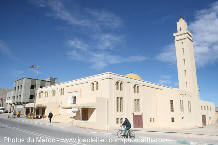
Missour ( Arabic ميسور, Zentralatlas-Tamazight ⵎⵉⵙⵓⵔ ) is a Moroccan city with about 25,000 inhabitants in the province of Boulemane in the Fès-Meknes region .
Location and climate
Missour is located on the upper reaches of the Oued Moulouya on the eastern edge of the Middle Atlas at an altitude of about 895 m between Midelt (about 90 km to the southwest) and Guercif (about 174 km northeast). The highest mountain of the Middle Atlas, the Jbel Bou Naceur , is about 70 km (as the crow flies) north at Outat El Haj . The climate is semi-desert; the extremely sparse rain (approx. 190 mm / year) falls almost exclusively in the winter half-year.
Population development
| year | 1994 | 2004 | 2014 |
| Residents | 12,777 | 20,978 | 25,584 |
Most of the inhabitants who immigrated from the surrounding mountain and desert regions of northern and eastern Morocco in the second half of the 20th century are mostly of Berber descent. However, Moroccan Arabic is usually spoken .
economy
In the surrounding villages, there is a small amount of agriculture and livestock (sheep, goats, chickens) raised. Carpets are also woven at home in the surrounding villages. The small town itself functions as a regional craft, trade and service center.
history
.jpg)
As is common in the Berber regions of the Maghreb , there are no written records of the earlier history of the place . The place only gained a certain regional importance during the French protectorate and after the independence of Morocco.