Monte Sief
| Monte Sief | ||
|---|---|---|
|
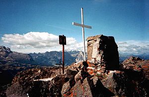
View from the top of Monte Sief |
||
| height | 2424 m slm | |
| location | Belluno Province , Italy | |
| Mountains | Fanes group , Dolomites | |
| Dominance | 0.55 km → Col di Lana | |
| Notch height | 70 m | |
| Coordinates | 46 ° 30 '4 " N , 11 ° 57' 15" E | |
|
|
||
The Monte Sief is a 2424 m high mountain in the Dolomites . It is in the Fanes group near Livinallongo del Col di Lana (German: Buchenstein ) in the Italian province of Belluno .
Like the neighboring Col di Lana, the mountain was fiercely contested between Austrians and Italians during the First World War . With the loss of the Col di Lana, Monte Sief was now part of the strategic planning of the Italians. The Austro-Hungarian troops had holed up on Monte Sief after the Col di Lana summit was blown up. The summit area was expanded. Despite multiple Italian attacks, this, like the Col di Lana, could not be stormed. So it was decided on the Italian side to build a blasting tunnel again. On March 6, 1917, the tunnel was blasted, but without achieving the same effect as on the neighboring Col di Lana. There were now smaller raiding forces on both sides again. On August 20, 1917, the last serious attempt to storm the top of the mountain was made. After the attack failed, the Italians detonated another mine on September 27, 1917. On October 21, 1917, the Austrians detonated a mine in order to destroy the Italian positions and another Italian mining tunnel. With the 12th Isonzo Battle and the breakthrough of the Austro-Hungarian and German troops at Karfreit , the Italian troops could no longer hold out without being cut off, and so the last Italians left the combat area on November 5, 1917.
Today, next to the summit cross, there is a memorial stone for the soldiers who died in the war on the summit . Trenches, trenches and mine trenches are still preserved from the war, some of which have been included in the hiking trail and are accessible.
The ascent is most comfortable from the Valparola pass or from Pieve di Livinallongo (1465 m) via the Rifugio Plan della Lasta.

