Motu One (Marquesas)
| Motu One | ||
|---|---|---|
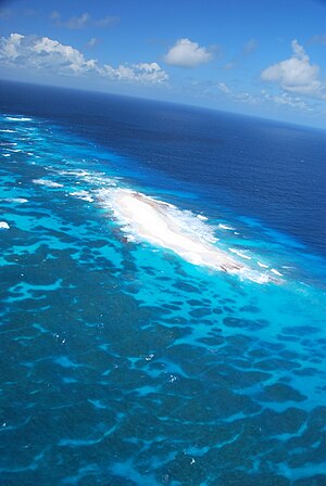
| Oblique aerial view of the island from the north-northeast | ||
| Waters | Pacific Ocean | |
| Archipelago | Marquesas | |
| Geographical location | 7 ° 51 ′ 0 ″ S , 140 ° 22 ′ 48 ″ W | |
|
|
||
| length | 300 m | |
| width | 100 m | |
| surface | 3 ha | |
| Highest elevation | 3 m | |
| Residents | uninhabited | |
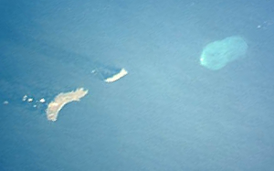
| Motu One east of Eiao and Hatutu | ||
Motu One (marq. For sand island , French Îlot de Sable ) is a small, uninhabited island of volcanic origin in the Pacific Ocean . It is located in the northern group of the Marquesas Islands, which politically belong to French Polynesia . It belongs to the commune associée Taiohae of the Nuku Hiva community .
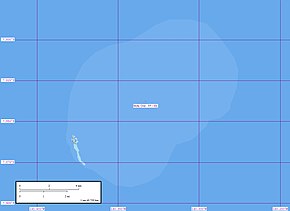
The island is located 30 km northeast of Eiao and 9 km east of Hatutu . Motu One is the last motu in the extreme southwest of a largely sunken atoll . It has an area of around three hectares and is only a few meters above sea level. The actual atoll has dimensions of about 14 × 9 km, with the longitudinal axis directed from northeast to southwest. The total area including the lagoon is around 100 km².
Although Motu One was visited by residents of the other Marquesas, there is no evidence of previous permanent settlement.
On April 19, 1791, the American Joseph Ingraham sailed past Motu One on his way to China without entering it. The island was first visited in 1813 by the American naval officer David Porter , who named it Lincoln Island . In 1992 Motu One was declared a nature reserve as it is home to sea turtles as well as numerous sea birds .
Individual evidence
- ↑ M. Quanchi and J. Robson: Historical Dictionary of the Discovery and Exploration of the Pacific Islands , Lanham (MD) - Tronto - Oxford 2005, p. 21


