Mount Bellingshausen
| Mount Bellingshausen | ||
|---|---|---|
| height | 1380 m | |
| location | Victoria Land , East Antarctica | |
| Mountains | Prince Albert Mountains , Transantarctic Mountains | |
| Coordinates | 75 ° 7 ′ 0 ″ S , 162 ° 6 ′ 0 ″ E | |
|
|
||
|
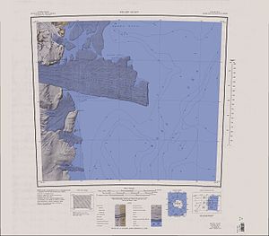
Map sheet Relief Inlet from 1966, southeast part of the Prince Albert Mountains with Mount Bellingshausen and Mount Stierer in the northwest of the map |
||
Mount Bellingshausen is a striking, conical mountain with a height of 1380 m . It stands around eight kilometers northeast of Mount Priestley between the Larsen Glacier and the David Glacier in the Prince Albert Mountains of the Antarctic Victoria Land .
The mountain was discovered by participants in the Discovery Expedition (1901–1904) led by the British polar explorer Robert Falcon Scott , who named it after the Baltic German navigator Fabian Gottlieb von Bellingshausen (1778–1852), who headed the first Russian Antarctic expedition (1819 -1821).
Web links
- Mount Bellingshausen in the Geographic Names Information System of the United States Geological Survey (English)
- Mount Bellingshausen on geographic.org (English)

