Mount Eisenhower
| Mount Eisenhower | ||
|---|---|---|
|
(Right) Mount Eisenhower on US Highway 302 near Bretton Woods saw |
||
| height | 1451 m | |
| location | New Hampshire , USA | |
| Mountains | Presidential Range | |
| Notch height | 105 m | |
| Coordinates | 44 ° 14 '44 " N , 71 ° 21' 2" W | |
|
|
||
| Normal way | trail | |
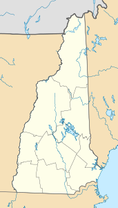
The Mount Eisenhower (former Mount Pleasant ) is a 1,451 m high mountain in the Presidential Range in the White Mountains (New Hampshire) that after the US president Dwight D. Eisenhower was named.
ways
The Crawford Path, part of the Appalachian Trail , runs over the mountain near the summit. It separates from the summit loop trail at 4,400 ft (1,341 m) elevation, 0.3 mi (0.48 km) south of the summit, and rejoins 0.3 mi (0 km) northeast of the summit after overcoming a 40 ft difference in elevation (12 m) on it and finally hits the maximum altitude of 4,520 ft (1,378 m).
The shortest hiking trail to the summit runs west-northwest from a parking lot on Mount Clinton Road, mainly via Edmands Path. Several routes begin from trailheads more or less southwest of US Highway 302 ; the most popular (possibly roughly equal in popularity to the Edmands Route) is Crawford Path from a parking lot on Mount Clinton Road, off US Highway 302 and just north of the Highland Center in the Crawford Notch area . Mount Monroe is located on the mountain range northeast of Mount Eisenhower and Mount Pierce in the southwest. All three of the peaks are on the Four-thousand footers peak-bagging list in New Hampshire. Mount Franklin , an "unofficial" summit (which is not on the list because of its low notch height ), lies between Mount Eisenhower and Mount Monroe.
Individual evidence
- ↑ Daniell, Gene, and Smith, Steven D. White Mountain Guide . 28th ed. AMC Books, 2007. ISBN 978-1-929173-34-1 . 41
Web links
- summitpost.org: Climbing information about Mount Eisenhower
- Mount Eisenhower on Peakbagger.com (English)
- hikethewhites.com: Hiking information

