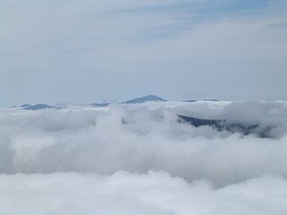
Presidential Range
| Presidential Range | |
|---|---|
|
View of the Presidential Range from Mount Lafayette in July 2004 |
|
| Highest peak | Mount Washington ( 1917 m ) |
| location | New Hampshire (USA) |
| part of | White Mountains |
| Coordinates | 44 ° 16 ′ N , 71 ° 18 ′ W |
The Presidential Range is a mountain ridge in the White Mountains in Coös County in the US state of New Hampshire .
Most of the notable mountain peaks in the mountain range are named after famous Americans, public figures of the 18th and 19th centuries or US presidents .
Noteworthy peaks
The Presidential Range consists of the following peaks (from southwest to northeast):
- Mount Webster - by Daniel Webster named
- Mount Jackson * - named after Charles Thomas Jackson (geologist in the 19th century)
- Mount Pierce * - named after Franklin Pierce (formerly Mount Clinton - named after DeWitt Clinton )
- Mount Eisenhower * - after Dwight Eisenhower named
- Mount Franklin for - Benjamin Franklin named
- Mount Monroe * - after James Monroe named
- Mount Washington * - named after George Washington (General and later US President)
- Mount Clay - named after Henry Clay (New Hampshire renamed the Mount Reagan mountain after Ronald Reagan ; but the US administration continues to use the old name)
- Mount Jefferson * - by Thomas Jefferson named
- Mount Sam Adams - by Samuel Adams named
- Mount Adams * - by John Adams named
- Mount Quincy Adams by - John Quincy Adams named
- Mount Madison * - according to James Madison named
In addition to its main peak, Mount Adams has four minor peaks that have no common name; two, Mount Sam Adams and Mount John Quincy Adams, are listed above. The third and fourth are:
- Adams 4 (The name "Mount Abigail Adams " was suggested)
- Adams 5
The peaks marked with an asterisk (*) are included in the peak bagging list of the Four thousand footers mountains in New Hampshire; others are not included due to insufficient amount or technical criteria.
Other peaks
In addition to the peaks worth mentioning, the Presidential Geological Range has a number of additional named peaks. Several of these peaks drain over the Dry River on their west side , are less accessible than the main peaks and less visited than the most visited ridge in the mountain range and can therefore be disregarded or mentioned in the discussion of the whole.
Mount Washington minor peaks:
- Ball Crag (6,106 ft (1,861 m ))
- Nelson Crag (5,620 ft (1,713 m))
- Boott Spur (5,500 ft (1,676 m))
North of Mount Washington:
- Mount Bowman (3,449 ft (1,051 m)) (minor summit of Mount Jefferson)
South of Mount Washington:
- Engine Hill (3,100 ft (945 m))
- Maple Mountain (2,601 ft (793 m))
- Iron Mountain (2,726 ft (831 m))
- Montalban Ridge:
- Mount Isolation (4,004 ft (1,220 m )) *
- Mount Davis (3,819 ft (1,164 m))
- Stairs Mountain (3,463 ft (1,056 m))
- Mount Resolution (3,415 ft (1,041 m))
- Bemis Ridge:
- Mount Crawford (3,119 ft (951 m))
- Mount Hope (2,505 ft (764 m))
- Mount Parker (3,004 ft (916 m))
- Mount Langdon (2,390 ft (728 m))
- Mount Pickering (1,945 ft (593 m)) (named for the family name of the first president of the Appalachian Mountain Club)
- Mount Stanton (1,716 ft (523 m ))
The peaks marked with an asterisk (*) are included in the peak bagging list of the Four thousand footers mountains in New Hampshire; others are not included due to insufficient amount or technical criteria.
Water catchment area
The Presidential Range separates the watershed of the Saco and Androscoggin Rivers , which flow into the Atlantic Ocean on the coast of Maine , from the watershed of the Israel and Ammonoosuc Rivers , which flow into the Connecticut River , which flows into Long Island Sound .
Show of strength
The so-called "Presidential Traverse" is a walking competition that is played 19 mi (31 km) of the ridge, with each main peak along the way included, creating an elevation gain of 8,500 ft (2,591 m). It can be held on a single summer day. During the winter, such crossings generally take two to four days, although experienced hikers can complete the hike in a single, long day with ideal weather conditions. Several rescues of lost, delayed, or injured hikers have occurred during the crossing.
