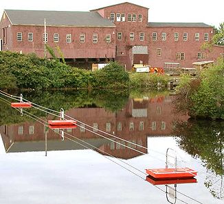
Saco River
| Saco River | ||
|
Saco River in Crawford Notch |
||
| Data | ||
| Water code | US : 574648 | |
| location | Maine , New Hampshire (USA) | |
| River system | Saco River | |
| origin |
Saco Lake in the White Mountains 44 ° 12 ′ 58 " N , 71 ° 24 ′ 34" W |
|
| muzzle |
Saco Bay (Atlantic Ocean) Coordinates: 43 ° 27 ′ 40 " N , 70 ° 22 ′ 37" W 43 ° 27 ′ 40 " N , 70 ° 22 ′ 37" W |
|
| Mouth height |
0 m
|
|
| length | 216 km | |
| Catchment area | 4411 km² | |
| Left tributaries | Ellis River | |
| Right tributaries | Swift River , Ossipee River , Little Ossipee River | |
| Medium-sized cities | Biddeford , Saco | |
| Small towns | Conway | |
| Communities | Hiram | |
|
Saco River catchment area |
||
|
Saco River in Saco, Maine - view from US Highway 1 |
||
The Saco River is a 216 km long river in northwest New Hampshire and southwest Maine in the United States .
It drains a rural area of 4411 km² west and southwest of Portland and flows into the Atlantic Ocean . It provides drinking water for 250,000 people.
course
The Saco River arises in Saco Lake in Crawford Notch in Coos County in the US state of New Hampshire in the White Mountains . It runs in a south-southeast direction through Carroll County in New Hampshire and Oxford County in Maine. In the further course he drives six hydroelectric plants and is crossed by Interstate 95 and reaches York County . There it flows between Saco and Biddeford , which are connected by a bridge on US Highway 1 . It reaches its confluence with the Atlantic Ocean in Saco Bay of the Gulf of Maine between Camp Ellis and Hills Beach.
Hydrography
The United States Geological Survey maintains two water level gauges along the river . The first is in Conway ( ⊙ ). The flow rate at this point is a long-term average (from 1904 to 2006) 27 m³ / s. The maximum value was 1339 m³ / s on March 27, 1953, and the lowest value of about 1 m³ / s was recorded on August 4, 1959. The second level is in Cornish , below the confluence of the Ossipee River ( ⊙ ). The highest flow rate was here on 21./22. March 1936 recorded with 1322 m³ / s and the lowest on October 7, 1964 was 7 m³ / s. The long-term average since 1916 is 77 m³ / s.
Major tributaries
- Dry River
- Sawyer River
- Rocky Branch
- Ellis River
- East Branch Saco River
- Swift River
- Cold River / Charles River
- Kezar Lake
- Kezar River
- Shepards River
- Tenmile River
- Ossipee River
- Little Ossipee River
Covered bridges
In Conway, the Saco River Covered Bridge spans the river.
Hydropower plants
There are several hydropower plants along the Saco River.
The hydropower plants in the downstream direction:
| Surname | Power in MW |
Number of turbines |
location | operator |
|---|---|---|---|---|
| Hiram | 10.5 | 2 | ( ⊙ ) | Brookfield Renewable |
| Bonny Eagle | 7.2 | 6th | ( ⊙ ) | Brookfield Renewable |
| West Buxton | 7.7 | 6th | ( ⊙ ) | Brookfield Renewable |
| Bar Mills | 4th | 2 | ( ⊙ ) | Brookfield Renewable |
| Skelton | 16.8 | 2 | ( ⊙ ) | Brookfield Renewable |
| Cataract | 6.6 | 1 | ( ⊙ ) | Brookfield Renewable |
Web links
Individual evidence
- ^ Saco River in the Geographic Names Information System of the United States Geological Survey
- ↑ Water Resources Data - New Hamspire, Water Year 2006 (PDF) In: Water Resources Data - New Hamspire, Water Year 2006 . 2006. Retrieved January 18, 2008.
- ↑ Water Resources Data - Maine, Water Year 2006 (PDF) In: Water Resources Data - Maine, Water Year 2001 . 2006. Retrieved January 18, 2008.
- ^ Saco River Covered Bridge in the Geographic Names Information System of the United States Geological Survey
- ↑ brookfieldrenewable.com
- ↑ energyjustice.net
- ↑ hydroreform.org


