York County (Maine)
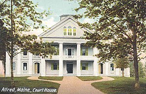
 York County Courthouse in Alfred |
|
| administration | |
|---|---|
| US state : | Maine |
| Administrative headquarters : | Alfred |
| Foundation : | 1636 |
| Demographics | |
| Residents : | 197,131 (2010) |
| Population density : | 76.8 inhabitants / km 2 |
| geography | |
| Total area : | 3293 km² |
| Water surface : | 726 km² |
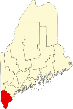
| map | |
| Website : www.yorkcountyme.gov | |
York County is a county in the US state of Maine in the United States . The county seat is in Alfred .
geography
According to the US Census Bureau , the county has a total area of 3,293 square kilometers. 726 square kilometers, or 22.06 percent, are water areas. The county is bordered by the counties in a clockwise direction: Oxford County , Cumberland County , Rockingham County, New Hampshire , Strafford County, New Hampshire, and Carroll County, New Hampshire .
history
Due to their historical significance, five of the county's sites have the status of National Historic Landmarks . A total of 178 buildings and sites in the county are listed on the National Register of Historic Places (as of November 11, 2017).
Demographic data
| growth of population | |||
|---|---|---|---|
| Census | Residents | ± in% | |
| 1790 | 28,892 | - | |
| 1800 | 37,896 | 31.2% | |
| 1810 | 41,877 | 10.5% | |
| 1820 | 46.283 | 10.5% | |
| 1830 | 51,722 | 11.8% | |
| 1840 | 54.034 | 4.5% | |
| 1850 | 60,098 | 11.2% | |
| 1860 | 62.107 | 3.3% | |
| 1870 | 60.174 | -3.1% | |
| 1880 | 62,257 | 3.5% | |
| 1890 | 62,829 | 0.9% | |
| 1900 | 64,885 | 3.3% | |
| 1910 | 68,526 | 5.6% | |
| 1920 | 70,696 | 3.2% | |
| 1930 | 72,934 | 3.2% | |
| 1940 | 82,550 | 13.2% | |
| 1950 | 93,541 | 13.3% | |
| 1960 | 99,402 | 6.3% | |
| 1970 | 111,576 | 12.2% | |
| 1980 | 139,666 | 25.2% | |
| 1990 | 164,587 | 17.8% | |
| 2000 | 186,742 | 13.5% | |
| 2010 | 197.131 | 5.6% | |
| Before 1900
1900–1990 2000 + 2010 |
|||

The county had a population of 186,742 people as of the 2000 census . There were 74,563 households and 50,851 families. The population density was 73 inhabitants per square kilometer. The racial the population was composed of 97.56% White, 0.42% African American, 0.24% Native American, 0.73% Asian, 0.03% Pacific Islander, and 0.17% other races Groups; 0.85% were from two or more races. Hispanic or Latino of any race was 0.70% of the population.
Of the 74,563 households, 32.20% had children and adolescents under the age of 18 living with them. 55.00% were married couples living together, 9.50% were a single mother. 31.80% were not families. 24.90% were single households and 9.70% had someone living there who was 65 years of age or over. The average household size was 2.47 and the average family size was 2.96 people.
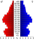
For the entire county, the population was composed of 24.80% of residents under 18 years of age, 6.90% between 18 and 24 years of age, 30.00% between 25 and 44 years of age, 24.80% between 45 and 64 years of age 13.60% were 65 years of age or over. The median age was 38 years. For every 100 females there were 94.50 males, and for every 100 females aged 18 and over there were 91.40 males.
The median income for a household in the county is $ 43,630 , and the median income for a family is $ 51,419. Males had a median income of $ 36,317 versus $ 26,016 for females. The per capita income was $ 21,225. 8.20% of the population and 5.90% of families are below the poverty line. 9.90% of these were under 18 years of age and 8.50% were 65 years of age or older.
cities and communes
York County is divided into 29 separate parishes. Below are two cities , the rest are towns . Plantations are not found in York County.
| Locality | status | Population (2010) |
Total area [km²] |
Land area [km²] |
Population density [inhabitants / km²] |
Foundation '' incorporated '' |
Specialty |
|---|---|---|---|---|---|---|---|
| Acton | town | 2,447 | 106.4 | 97.5 | 25.1 | 1830 | |
| Alfred | town | 3,019 | 72.3 | 70.6 | 42.8 | 1794 | Shire Town of York County |
| Arundel | town | 4.022 | 62.0 | 61.9 | 65.0 | 1915 | |
| Berwick | town | 7,246 | 97.3 | 96.1 | 75.4 | June 9, 1713 | |
| Biddeford | City | 21,277 | 89.5 | 77.7 | 273.8 | Nov 23, 1728 | |
| Buxton | town | 8,034 | 106.7 | 104.9 | 76.6 | July 1772 | |
| Cornish | town | 1,403 | 57.7 | 57.2 | 24.5 | Feb. 27, 1794 | |
| Dayton | town | 1.965 | 47.7 | 46.3 | 42.4 | 1854 | |
| Eliot | town | 6,204 | 55.1 | 51.1 | 121.4 | 1st Mar 1810 | |
| Hollis | town | 4,281 | 85.3 | 82.9 | 51.6 | Feb. 27, 1798 | |
| Kennebunk | town | 10,798 | 92.0 | 90.9 | 118.8 | June 24, 1820 | |
| Kennebunkport | town | 3,474 | 56.9 | 53.4 | 65.1 | July 5, 1653 | |
| Kittery | town | 9,490 | 54.4 | 46.2 | 205.4 | 1647 | |
| Lebanon | town | 6,031 | 144.5 | 141.7 | 42.6 | June 25, 1767 | |
| limerick | town | 2,892 | 73.1 | 70.3 | 41.1 | 6th Mar 1787 | |
| Limington | town | 3.713 | 112.1 | 108.7 | 34.2 | 1792 | |
| Lyman | town | 4,344 | 104.7 | 100.9 | 43.1 | 11th Mar 1778 | |
| Newfield | town | 1,522 | 86.7 | 83.7 | 18.2 | 1794 | |
| North Berwick | town | 4,576 | 99.6 | 99.2 | 46.1 | 1831 | |
| Ogunquit | town | 892 | 11.1 | 10.6 | 84.2 | 1980 | |
| Old Orchard Beach | town | 8,624 | 19.5 | 19.3 | 446.8 | Feb. 20, 1883 | |
| Parsonsfield | town | 1,898 | 155.5 | 152.7 | 12.4 | 9 Mar 1785 | |
| Saco | City | 18,482 | 101.9 | 99.7 | 185.4 | 1762 | |
| Sanford | town | 20,798 | 126.2 | 123.8 | 168.0 | 23 Feb 1768 | |
| Shapleigh | town | 2,668 | 106.8 | 100.5 | 26.5 | 5th Mar 1785 | |
| South Berwick | town | 7,220 | 84.6 | 83.3 | 86.7 | 1814 | |
| Waterboro | town | 7,693 | 148.6 | 143.8 | 53.5 | 6th Mar 1787 | |
| Wells | town | 9,589 | 150.6 | 149.3 | 64.2 | 1653 | |
| York | town | 12,529 | 149.4 | 142.2 | 88.1 | 1652 |
Individual evidence
- ↑ GNIS-ID: 581301. Retrieved on February 22, 2011 (English).
- ↑ Listing of National Historic Landmarks by State: Maine . National Park Service , accessed November 11, 2017.
- ↑ Search mask database in the National Register Information System. National Park Service , accessed November 11, 2017.
- ↑ US Census Bureau - Census of Population and Housing . Retrieved March 15, 2011
- ↑ Extract from Census.gov . Retrieved February 28, 2011
- ↑ Extract from census.gov (2000 + 2010). Accessed April 2, 2012
- ^ Extract from the National Register of Historic Places . Retrieved March 13, 2011
- ↑ Listed on the official Mains administration website (in English)
- ↑ Population data from the 2010 US Census in the American Factfinder
- ^ AJ Coolidge and JB Mansfield: A History and Description of New England, general and local ; Boston 1859; part 1
Web links
Coordinates: 43 ° 25 ′ N , 70 ° 40 ′ W


