Mount Kauffman
| Mount Kauffman | ||
|---|---|---|
|
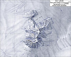
Topographic map of the Ames Range with Mount Kauffman (scale 1: 250,000) |
||
| height | 2364 m | |
| location | Marie Byrd Land | |
| Mountains | Ames Range | |
| Coordinates | 75 ° 37 ′ 0 ″ S , 132 ° 25 ′ 0 ″ W | |
|
|
||
| Type | Shield volcano | |
| Normal way | Alpine tour (glaciated) | |
Mount Kauffman is a striking and 2364 m high mountain in the west Antarctic Marie-Byrd-Land . It looms at the northwest end of the Ames Range .
Like the other mountains of the Ames Range, Mount Kauffman is a dormant or extinct shield volcano that was formed in the Miocene and Pliocene . Weak fumaroles on the north flank indicate the volcanic nature of the mountain.
The United States Geological Survey mapped it using its own measurements and aerial photographs of the United States Navy from 1959 to 1965. The Advisory Committee on Antarctic Names named it in 1966 after Commander Steven King Kauffman (* 1926) of the US Navy, who carried out the planning and supervised the construction of the plateau station on the Crown Prince Olav Coast between 1965 and 1966.
Web links
- Mount Kauffman in the Geographic Names Information System of the United States Geological Survey (English)
- Mount Kauffman on geographic.org (English)
Individual evidence
- ↑ Lucia Sala Simian: Literature Review (Anta 502): The volcanoes of Marie Byrd Land and their importance in understanding the tectonics of West Antarctica as well as the reconstruction of the West Antarctic ice sheet (WAIS) in the last interglacial. (PDF; 123 kB) Graduate Course in Antarctic Studies 2004–2005. University of Canterbury , January 10, 2005, accessed August 24, 2017 .
- ^ Matthew R. Patrick, John L. Smellie, Synthesis A spaceborne inventory of volcanic activity in Antarctica and southern oceans, 2000-10 . In: Antarctic Science . tape 25 , no. 4 , August 2013, ISSN 0954-1020 , Antarctica and adjacent islands: Mount Berlin, Mount Kauffman, Mount Siple, p. 481 , doi : 10.1017 / S0954102013000436 (English).

