Mount Temple
| Mount Temple | ||
|---|---|---|
|
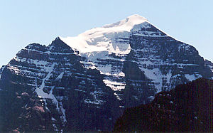
North side of the mountain from Fairview Mountain seen from |
||
| height | 3547 m | |
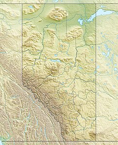
| location | Alberta ( Canada ) | |
| Mountains | Canadian Rockies | |
| Dominance | 21.24 km → Mount Goodsir | |
| Notch height | 1520 m ↓ Ottertail Pass (2020 m) | |
| Coordinates | 51 ° 21 '4 " N , 116 ° 12' 23" W | |
|
|
||
| First ascent | 1894 by Walter Wilcox , Samuel Allen and LF Frissel | |
The Temple Mount is a mountain in the Canadian Rockies in Banff National Park in the Canadian province of Alberta .
The mountain lies in the Bow River Valley between Paradise Creek and Moraine Creek and is the highest mountain in the Lake Louise region .
The mountain was named by George Mercer Dawson in 1884 in honor of Sir Richard Temple . On July 11, 1955, seven young male Americans were killed on the south-west route in one of the most serious mountaineering accidents in Canada . On a warm summer day they were hit by an avalanche and torn down 200 meters in altitude. The bionic scientist Hugh Herr , who later lost both lower legs after frostbite, climbed Mount Temple at the age of eight (1973).
Web links
- Mount Temple on GeoFinder.ch
- Mount Temple, Alberta on Peakbagger.com (English)

