Murrupula (District)
| Murrupula district | |
|---|---|
 Location of the Murrupula district in Mozambique |
|
| Basic data | |
| Country | Mozambique |
| province | Nampula |
| surface | 3119 km² |
| Residents | 162,673 (2013) |
| density | 52 inhabitants per km² |
| ISO 3166-2 | MZ-N |
Coordinates: 15 ° 28 ′ S , 38 ° 41 ′ E
Murrupula is a district of the Nampula Province in Mozambique with the administrative seat in the city of Murrupula . Its territory borders in the north on the districts of Nampula (city district) and Ribauè , in the west on the district Ribauè, in the south on the province Zambezia and in the east on the districts Nampula (city district) and Mogovolas .
geography
With an area of 3,119 square kilometers, Murrupula has 162,673 inhabitants (as of 2013). This gives a population density of 52 people per square kilometer. The region has a dry climate with an annual rainfall of 800 to 1,200 millimeters. Locally, the annual rainfall can also exceed 1,500 millimeters. The average annual temperature is between 20 and 25 degrees Celsius, in some regions even higher.
|
Climate table Murrupula (city)
Source:
|
||||||||||||||||||||||||||||||||||||||||||||||||||||||||||||||||||||||||||||||||||||||||||
The district is hilly with an altitude of 200 to 500 meters above sea level. Murrupula is drained by the two rivers Mecúburi and Lúrio , which regularly flood their surroundings. The island mountains, bare rock formations that tower above the surroundings, are striking.
population
| The majority of the population of Murrupula belongs to the Makua ethnic group , which in turn is subdivided into Adjeletche, Ayatche, Amirasi, Alaponi, Amulima, Amale. Some of them stick to their old rites and traditional religion.
Makua is the predominant mother tongue. Almost eighty percent of the population aged five and over does not speak Portuguese. While almost half are Christians in the province, their proportion in Murrupula is about a third. On the other hand, the proportion of people with "other or no" religious beliefs is particularly high. As in many districts of Mozambique, the population is very young: over 18 percent of the population are under five years old, over 26 percent are between five and fourteen years of age. |
 |
Facilities and services
There are 121 primary schools ( Primárias) and seven secondary schools (Secundárias) in the district . Of the primary schools, 80 are public schools and 41 are private schools, and all of the secondary schools are public. In primary schools the student-teacher ratio is 68: 1, in secondary schools 35: 1. A quarter of the teachers in primary schools are untrained, in secondary schools a third (as of 2013).
There are four health centers and two health stations in Murrupula (as of 2011).
Administrative division
The Murrupula district is divided into three administrative posts ( postos administrativos ):
Economy and Infrastructure
In 2007, 42 percent of households had a radio and 0.2 percent a television. 44 percent owned a bicycle and 0.1 percent owned a car.
AgricultureAgriculture is the most important source of income for the population. In 2010 there were 31,332 farms with an average size of 1.1 hectares. The farms are mostly run manually as family businesses. Three or more family members work in over 80 percent of the companies, and children under ten years of age also work in 40 percent. The main crops are maize, cassava, beans, peanuts and sweet potatoes, and cotton in the river plains. In addition, fruit trees, coconut palms and cashew trees are tended and 5,000 cattle breeders keep around 26,000 poultry. Many families secure additional income through the sale of firewood, reeds and charcoal, as well as through hunting and fishing. BusinessThere are only small local manufacturing companies (e.g. fishing, carpentry) as an alternative to or as an extension of the predominant agricultural activity. The craft area also includes mills, sawmills, a cashew processing plant with around 150 employees and a rice husking factory. Natural resourcesNo natural resources are mined in Murrupula. trafficThere are no national roads or rail links running through the district. |
 |
Personalities
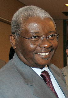
Armando Guebuza , President of Mozambique from 2005 to 2015, was born in Murrupula.
Individual evidence
- ↑ a b c d Instituto Nacional de Estatístic, Estatísticas do Distrito de Murrupula. (pdf) November 2013, accessed June 16, 2019 (Portuguese).
- ↑ Climate-Data, Murrupula. Retrieved June 16, 2019 .
- ↑ a b c d Republic of Mozambique, "Perfil do Distrito do Murrupula. (Pdf) 2005, accessed on June 16, 2019 (Portuguese).

