Nösslachjoch
| Nösslachjoch | ||
|---|---|---|
|
The Nösslachjoch from the north |
||
| height | 2231 m above sea level A. | |
| location | Tyrol , Austria | |
| Mountains | Stubai Alps | |
| Dominance | 1 km → Eggerberg | |
| Notch height | 60 m | |
| Coordinates | 47 ° 3 '29 " N , 11 ° 26' 29" E | |
|
|
||
| rock | Quartz phyllite | |
| Development | Ski area | |
The Nösslachjoch , also called Steinacher Jöchl , is 2231 m above sea level. A. high mountain in the Stubai Alps in Tyrol .
Location and surroundings
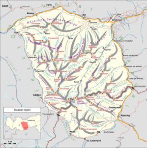
The Nösslachjoch is located south of Steinach am Brenner , it is the northeasternmost summit of the ridge that separates the Gschnitztal from the Obernbergtal . The eponymous town of Nösslach in the municipality of Gries am Brenner is located on the eastern slope of the Wipptal valley . The Nösslachjoch is located in the municipal areas of Steinach, Trins and Gries am Brenner, which meet at the summit.
It is a gentle hilltop that is overgrown by Almmatten up to the summit . A larch forest follows below . The summit cross stands on a slightly lower elevation ( 2221 m above sea level ) north-northeast of the actual summit. The mountain is part of the conservation area, Nößlachjoch - Upper Lake Starnberg - Tribulaune .
Geology and mining
The Nösslachjoch is part of the Steinacher Nappe , which stretches as a tectonic cover between Gschnitztal and Pflerschtal . This consists of quartz phyllite with enclosed lenses of iron dolomite. On the south-eastern slope of the Nösslachjoch, at an altitude of around 1700 to 1900 m, there are anthracite coal containing plant fossils - seams from the Upper Carboniferous . From the 19th century coal was mined here, which was initially not used as fuel but as a natural color, especially for coloring tobacco, and was called Nösslacher black earth . With the increased demand, the coal was mined from the 1930s onwards. A total of five tunnels with a total length of around 1300 m were created. In the 1940s and 50s, around 5000 tons of hard coal were extracted each year. Due to the poor usability and the exhaustion of supplies, the mining was stopped in 1953. In 2006, the Nösslachjoch mine path was laid out, which provides insights into historical mining.
use
The Bergeralm ski area is located on the northern and eastern slopes , with lifts reaching just below the summit. The mountain is also popular for ski tours.
literature
- Rudolf Oberhauser, Franz Karl Bauer (ed.): The geological structure of Austria. Springer-Verlag, Vienna 1980, p. 341 ( book in Google book search)
- Oskar Schulz, Herbert W. Fuchs: Coal in Tyrol: A historical, coal-petrological and deposit-related consideration. In: Archive for Deposit Research of the Federal Geological Institute, Volume 13, 1991, pp. 123–213 ( PDF; 10.9 MB )
- O. Schmidegg: The geological structure of the Steinacher Nappe with the anthracite coal seam on the Nößlachjoch (Brenner area). In: Publications of the Tiroler Landesmuseum Ferdinandeum 26–29, 1946/49, pp. 1–19 ( PDF; 8.4 MB )
- Richard Penz: Glück-Auf to the Nößlacher Bergwerksweg. The 150-year history of mining in Nößlach has been preserved for posterity with an educational trail. In: Werbung Broatige, Die Grieser Gemeindezeitung, Volume 8, Issue 34, 12/2006, pp. 2–3 ( PDF; 717 kB )

