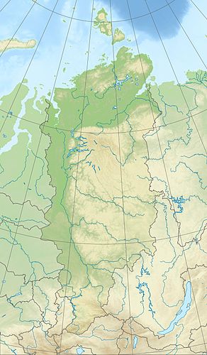
Nakomjakensee
|
Nakomjakensee (Озеро Накомякен) |
||
|---|---|---|
| GKZ | RU / 17020000111116100011307 | |
| Geographical location |
Putorana Mountains , Krasnoyarsk Region ( Russia ) |
|
| Tributaries |
Tonelj , Nerungda, Langa and other mountain streams |
|
| Drain | Nakma | |
| Places on the shore | no | |
| Data | ||
| Coordinates | 68 ° 54 '48 " N , 90 ° 55' 30" E | |
|
|
||
| Altitude above sea level | 89 m | |
| surface | 46 km² | |
| length | approx. 32 km | |
| width | Max. approx. 2 km | |
| Catchment area | 1330 km² | |
The Nakomjakensee ( Russian Озеро Накомякен ) is a 46 km² lake in the Putorana Mountains , the northwest part of the Central Siberian Mountains in the Krasnoyarsk region , Siberia , Russia ( Asia ).
Geographical location
The Nakomjakensee is located around 260 km north of the Arctic Circle in the western part of the Putorana Mountains (max. 1701 m ). There are no settlements either by the lake or in its vicinity, but in some places there are isbas , traditional Russian wooden huts.
The mountains to the east of the northeastern end of the lake are up to 1181 m high; The mountain parts near the lake include the northern Nakomjakenberge (up to 1010 m ), the northeastern Akyrma mountains (up to 818 m ), the southwestern Toneljberge (up to 950 m ) and the eastern Tango mountains (up to 1033 m ). While the lake is fed by Tonelj , Nerungda and Langa as well as many other streams, the Nakma on the north-east bank is its only outflow, whose water ultimately flows over the distant Pyassina to the Kara Sea (part of the Arctic Ocean ).
The lake, which extends roughly in a south-west-north-east direction and is around 89 m high, is around 32 km long and up to 2 km wide in the middle. Its catchment area is around 1,330 km².
In the catchment area of the Nakomjakensee in the southwest of the small Toneljsee and also many small lakes and rivers. Outside this area, below the lake, there is the Sobatschjesee, which is fed by the Nakma .
Climate, flora and fauna
The region of Lake Nakomjak is in the area of permafrost . The lake is covered by ice from the beginning of October to the end of June or the beginning of July every year . Boreal coniferous forests (taiga) thrive on its banks and tundra with mosses and lichens predominate on the many plateau-like mountains . Perch and salmon fish live in the fish-rich lake .
Individual evidence
- ↑ a b c d Nakomjakensee in the State Water Directory of the Russian Federation (Russian)
- ↑ a b c d e f topographic map (1: 200.000, p. R-46-XXV, XXVI, edition 1988), Nakomjakensee (center right) in the Putorana mountains and a. with these lakes: Glubokoe (top left), Sobatschje (southeast of), chum (bottom left), Tonelj (north of it) and Kutaramakan (bottom right) on mapr45.narod.ru
