Keta Lake
| Keta Lake | ||
|---|---|---|

|
||
|
Lake Keta with Lake Nakomjak (above) and Lake Kutaramakan (below right) in the Putorana Mountains ( NASA photo) |
||
| GKZ | RU / 17020000111116100011345 | |
| Geographical location |
Putorana Mountains , Krasnoyarsk Region ( Russia ) |
|
| Tributaries | Tokinda and many mountain streams | |
| Drain | Rybnaya | |
| Data | ||
| Coordinates | 68 ° 44 ′ N , 90 ° 4 ′ E | |
|
|
||
| Altitude above sea level | 85 m | |
| surface | 452 km² | |
| length | approx. 94 km | |
| width | Max. approx. 14 km | |
| scope | approx. 235 km | |
| Maximum depth | approx. 180 m | |
| Catchment area | 2990 km² | |
Lake Keta ( Russian Озеро Кета ), also called Lake Kema (Озеро Кема), is a 452 km² lake in the Putorana Mountains , the northwestern part of the Central Siberian Mountains in the Krasnoyarsk region , Siberia , Russia ( Asia ).
Geographical location
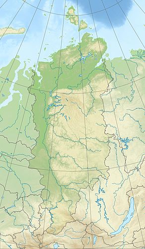
The Keta Lake is 250 km north of the Arctic Circle in the western part of the Putorana Mountains. While it is fed by the Tokinda and many mountain streams, the Rybnaya is its only drain; this drains over the Norilka into the Pjassinosee and thus to the Pjassina . The approx. 85 m high lake is approx. 94 km long, a maximum of approx. 14 km wide and up to approx. 180 m deep. Its catchment area is about 2,990 km². The mountains on the lake are up to 1170 m high at its eastern end . There are no settlements either by the lake or in its vicinity.
Climate, flora and fauna
The region of Lake Keto lies in the area of permafrost . The lake is covered by ice from October to June or July every year . Boreal coniferous forests (taiga) thrive on its banks and the tundra with its mosses and lichens dominates the surrounding mountains . In the fish-rich lake, for example, perch fish , pike , salmon fish such as whitefish, vendace or whitefish (see Coregonus ), as well as grayling and burbot live .
Individual evidence
- ↑ a b c d Keta Lake in the State Water Register of the Russian Federation (Russian)
-
↑ Topographic map (1: 1,000,000, p. R-45,46, ed. 1990), u. a. with the
entire lake (bottom center) on mapr46.narod.ru (with height above sea level ) -
↑ Topographic map (1: 200.000, p. R-46-XXV, XXVI, edition 1988), u. a. with the
main part of the lake (bottom left; with height information) on mapr46.narod.ru,
see also:
Topographic map (1: 200.000, p. R-45-XXIX, XXX, edition 1989), u. a. with the
western part of the lake (far right below; with height information) on mapr45.narod.ru
