Glubokojesee
|
Glubokojesee (Озеро Глубокое) |
||
|---|---|---|
| GKZ | RU / 17020000111116100011284 | |
| Geographical location |
Putorana Mountains , Krasnoyarsk Region , Siberia , Russia ( Asia ) |
|
| Tributaries | Muksun , Gudke-Daltu and other mountain streams | |
| Drain | Glubokaya | |
| Places on the shore | no | |
| Data | ||
| Coordinates | 69 ° 16 '2 " N , 90 ° 8' 10" O | |
|
|
||
| Altitude above sea level | 49 m | |
| surface | approx. 143 km² | |
| length | approx. 42 km | |
| width | Max. approx. 8.7 km | |
| Middle deep | 16 m | |
| Catchment area | approx. 4,400 km² | |
| The catchment area of the Glubokojesees | ||
The Glubokojesee ( Russian Озеро Глубокое , "deep lake"), or Omuk-Kjuol (Омук-Кюёль), is an approximately 143 km² large lake in the Putorana Mountains , the northwest part of the Central Siberian Mountains in the Krasnoyarsk region , Siberia , Russia ( Asia ).
Geographical location
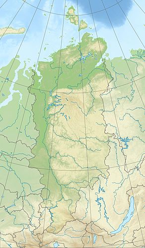
The Glubokojesee is located around 315 km north of the Arctic Circle in the western part of the Putorana Mountains (max. 1701 m ). It lies on average around 75 km east-southeast of Norilsk . There are no settlements on the lake or in the surrounding area, but in some places there are isbas , traditional Russian wooden huts , on its banks .
The surrounding mountains are north in the Lamskieberge n up to 973 m , east in the same mountain range up to 1112 m , southeast in the Dynkengdabergen up to 1177 m and south in the Iman mountains up to 1135 m . While the lake is fed by the Muksun and numerous mountain streams, the Glubokaja is its only outflow, the water of which flows via Talaja , Norilka and Pjassina to the Kara Sea (part of the Arctic Ocean ).
The lake, located about 49 m high, is about 42 km long and 8.7 km wide. It is 16 m deep on average. The water temperature rarely reaches more than 10 ° C, even in summer. Its catchment area is around 4,400 km².
In the catchment area of the Glubokojesees there are the small Gudkesee in the south and the Sobatschjesee in the southeast with the Nakomjakensee and its neighboring lake Tonelj as well as many small lakes and rivers. Outside this area, below the lake, there is the neighboring lake, for example the Melkojesee, which is fed by the Glubokaja .
Climate, flora and fauna
The region of the Glubokojesees lies in the area of the permafrost soil . The lake is covered by ice from the beginning of October to the end of June or the beginning of July every year . Boreal coniferous forests (taiga) thrive on its banks, which are partly flat and sandy in the west and have many small lakes in the swampy hinterland, and tundra with mosses and lichens predominates on the many plateau-like mountains . The fish-rich lake is home to perch such as the river perch and salmonids such as grayling and arctic char .
Individual evidence
- ↑ a b c d Glubokojesee in the State Water Register of Russia (Russian)
- ↑ a b c d e topographic map (1: 200.000, p. R-45-XXIII, XXIV, edition 1989), Glubokojesee-Nordwestteil (bottom right) and a. with Melkojesee -Northeast part (left next to it), Lama Lake -West part (right), Putorana Mountains (above), Pjassinosee -Südsüdostteil (left), Norilka (diagonal, left below), Norilsk (left below) on mapr45.narod.ru ( with height above sea level ); see also (connection maps ): Topographic map (1: 200.000, Bl. R-45-XXIX, XXX, Ed. 1989), Glubokojesee-Westteil (top right), u. a. with Melkojesee -Südwestteil (to its left), putorana plateau (right), Lake Keta -Westteil (bottom right), Rybnaja (diagonal), Lontokoiski-Kamen Mountains (left) and Norilsk (top left) on mapr45.narod.ru and topographic map (1: 200.000, Bl. R-46-XXV, XXVI, Ed. 1988), Glubokojesee-Südost- or main part (top left) in the Putorana Mountains and a. with these lakes (from north to south): Sobatschje , Nakomjaken , Keta (bottom left) and Kutaramakan (bottom right) on mapr45.narod.ru
