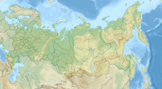
Lontokoiski-Kamen Mountains
| Lontokoiski-Kamen Mountains (хребет Лонтокойский Камень) |
||
|---|---|---|
| Highest peak | Kulgachmach ( 760 m ) | |
| location |
Krasnoyarsk Region , Siberia , Russia ( Asia ) |
|
| part of | Central Siberian mountain country | |
|
|
||
| Coordinates | 68 ° 52 ′ N , 88 ° 16 ′ E | |
The Lontokoiski-Kamen Mountains ( Russian хребет Лонтокойский Камень ) are up to about 760 m high low mountain range of the Central Siberian mountain region , located in the north of Siberia , the Krasnoyarsk region and Russia ( Asia ).
geography
Geographical location
The Lontokoiski-Kamen Mountains are on average around 240 km north of the Arctic Circle . As the outermost north-western foothills of the Central Siberian mountainous region, its landscape leads in eastern directions over the river valleys of Norilka , Rybnaja , with Lake Keta , and Chantaika , with Lake Chantaika , to the much larger and higher Putorana Mountains (max. 1701 m ). To the west it falls into the extensive West Siberian lowlands , in which the river basins of the nearby Yenisei and the distant Ob lie in particular . North of the mountains is the city of Norilsk and south of the Chantaika reservoir. The mountain range is around 115 to 120 km long in north-south direction and around 50 to 60 km wide in west-east direction.
Mountains and waters
The highest mountain in the Lontokoiski-Kamen Mountains is the Kulgachmach (approx. 760 m ; ⊙ ) located near the source of the Southern Ergalach . The largest river is the Dudinka , which has its source in the southern part of the mountains, flows northwest, for example, is fed by the Southern Ergalach and flows into the Yenisei , and the Norilka (northeast), Rybnaja (east), Chantaika (south) and Yenisei flow in the vicinity (West). There are many rapids and waterfalls in the rivers running in the mountains and in their foothills, with mostly rocky water beds . There are also numerous small lakes, the largest of which is called Tschibitscheme , the water of which flows over the Tschibitscheme mountain stream westward into the Dudinka. In its surroundings are among others Lake Pyasino (some distance to the north), Melkojesee (northeast) and Chantaikastausee (southeast and south), the latter south of the mountain located at some snezhnogorsk on hydroelectric power station Ust-Khantayka River is dammed.
Localities
There are no settlements in the Lontokoiski-Kamen Mountains and on its eastern, southern and western edges. On its northern foothills, however, the only large city is Norilsk and Kajerkan, a little to the west . Far to the northwest, at the confluence of the Dudinka and the Yenisei, Dudinka is located, and some to the south is at the Khantaika reservoir, Snezhnogorsk .
geology
From a geological point of view, the Lontokoiski-Kamen Mountains are almost entirely made up of basalts and related rocks that belong to the volcanism of the Siberian Trapp . There are deposits of ore , copper , palladium and especially nickel . The northern, eastern and southern mountain slopes mostly have a steep slope, while the western slopes are more gentle. In many places the landscape is rugged and - typical of frost rubble deserts - heavily weathered.
Climate and flora
The Lontokoiski-Kamen Mountains have a harsh continental climate , with the exception of the southern valley locations, which are less exposed to cold north winds . Most of the precipitation falls in summer. In the winters with little precipitation, only a small amount of snow is usually formed, which is then retained for a long time. As a result of climate change, the permafrost is increasingly thawing and therefore becoming muddy. Boreal coniferous forests (taiga) with spruce and larch trees spread out in the valleys , and on the rocky high altitudes the tundra is covered with lichen and moss .

environmental pollution
The industrial plants of the MMC Norilsk Nickel group , the world market leader in the production of nickel and palladium , with open-cast mines located in the northern foothills of the Lontokoiski-Kamen Mountains near Norilsk and Kajerkan and near Talnach on the Putorana Mountains , lead to severe environmental pollution . Therefore, especially in the north, the mountains are heavily polluted with heavy metals and various environmental toxins.
Individual evidence
- ↑ Topographical map (1: 500.000, p. R-45, D, edition 1988), Lontokoiski-Kamen-Gebirge u. a. with Yenisei (left), Lake Pyasino (above), Norilsk (below), Rybnaja (right), putorana plateau (far right), Chantaikastausee (below), on mapr45.narod.ru (with heights above sea )
