Kajerkan
| District of Norilsk
Kajerkan
Кайеркан
|
||||||||||||||||||||||||||||||||
|
||||||||||||||||||||||||||||||||
|
||||||||||||||||||||||||||||||||
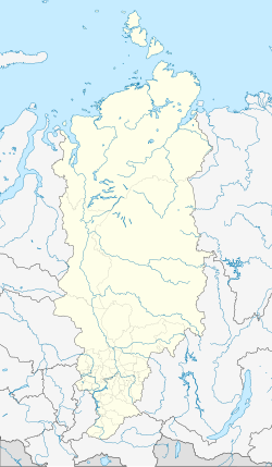
Kajerkan ( Russian Кайеркан ) is a formerly independent city, today's district of Norilsk in the north of the Krasnoyarsk region ( Russia ) with 22,338 inhabitants (as of October 14, 2010).
The place is located about 30 km west of the center of Norilsk, with which it is connected by a road, south of Lake Pyasino and about 1560 kilometers north of Krasnoyarsk , the capital of the region.
history
The emergence of Kajerkan is connected with the discovery of coal and other mineral resources. Prospecting began in 1940 , the first mine was opened in 1943 and Kajerkan was founded; coal mining began in 1945. In 1947 the railway line to Norilsk started operating. The prisoners from the nearby labor camps helped to rebuild the city . These were dissolved from 1956 and more and more voluntary workers came to Kajerkan, which also meant that the town was supplied with public services. In 1957 Kajerkan received urban-type settlement status and was named a town in 1982. In 2004, like Talnach , it was incorporated into Norilsk.
Population development
| year | Residents |
|---|---|
| 1959 | 5,167 |
| 1970 | 4,748 |
| 1979 | 18,013 |
| 1989 | 27,881 |
| 2002 | 27,116 |
| 2010 | 22,338 |
Note: census data
climate
The climate around Kajerkan is continentally dry with warm humid summers (three months) and long, harsh winters (nine months).
- Average temperature in July 14-16 ° C. Precipitation in July 44 mm.
- Average temperature in January −22 ° C. Precipitation in January 12 mm.
Economy and Infrastructure
In addition to the mining of hard coal in open-cast mining , Kajerkan is an important location for metallurgy. The Nadjeschdinsk metallurgical plant processes coal and ores from the area.
Kajerkan is home to several schools and medical infrastructure. The scientific research laboratory for non-ferrous metals located in Kajerkan occupies a leading position in the metallurgy of Russia.
Kajerkan is located on the Dudinka-Norilsk railway line and is the junction of several trunk roads. The Norilsk airport is located a few kilometers west of the town.
Individual evidence
- ↑ a b Itogi Vserossijskoj perepisi naselenija 2010 goda. Tom 1. Čislennostʹ i razmeščenie naselenija (Results of the All-Russian Census 2010. Volume 1. Number and distribution of the population). Tables 5 , pp. 12-209; 11 , pp. 312–979 (download from the website of the Federal Service for State Statistics of the Russian Federation)
- ↑ a b c d e f g h i j А. С. Вдовин: Кайеркан . In: В.А. Ламин (Ed.): Историческая Энциклопедия Сибири . tape 2 . Издательский дом "Историческое наследие Сибири", 2010, ISBN 5-8402-0231-2 , p. 15-16 .
Web links
- Official local website (Russian)


