Nape pass
| Nape Pass, Keo Neua Pass |
|||
|---|---|---|---|
|
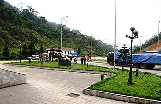
Border control at the Keo Neua Pass |
|||
| Compass direction | Northeast | southwest | |
| Pass height | 722 m | ||
| District | Hương Sơn, Hà Tĩnh , Vietnam | Kham Keut, Bolikhamsai , Laos | |
| Watershed | Nam Chot | Nam Phao | |
| Valley locations | Nước Sốt | Ban Nape | |
| expansion | Pass road | ||
| Card (Bolikhamsai) | |||
|
|
|||
| Coordinates | 18 ° 23 '12 " N , 105 ° 9' 32" E | ||
The Nape Pass or Keo Neua Pass ( Vietnamese : Đèo Keo Nưa , Lao : Hom Chomphoukèo-Nua ) is a mountain pass in the Truong Son Mountains , which connects Vietnam with Laos . The passport played an important role during the wars in Vietnam.
Location and course
The Nape Pass is located approximately 60 km southwest of Vinh , capital of the Nghệ An province in northern Vietnam, and 150 km east of Thakhek , capital of the Lao province of Khammuan .
In the highlands of North Vietnam, the national road 8A from Cho Pho leads first along the Ngan Pho river, then the Nam Sot river, from where it meanders up the right flank of the valley to the pass at 722 m. There is the Cau Treo border post on the Vietnamese side and the Namphao border post on the Lao side. From here the national road 8 leads along the Nam Phao via Ban Gnômmalat to Lak Sao . The top 15 km of the road lead through the Nakai – Nam Theun nature reserve .
history

The road over the pass was already expanded during the French colonial era .
As part of the second Lao civil war , the first fighting broke out on the Lao side of the pass road. At the Battle of Lak Sao, which lasted from November 1963 to January 1964, the Laos royal armed forces fought with the Vietnamese People's Army .
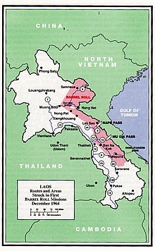
The Nape Pass, together with the Mu Gia Pass further south, was an important entry point into the Ho Chi Minh Trail . This road and traffic route system through Laos towards South Vietnam served as an important supply line for North Vietnam in the Indochina War and the Vietnam War to support the fighters in the south.
At the beginning of the Vietnam War , the Nape Pass was used. As a result, it was also the target of the first bombing raids as part of the secret mission Operation Barrel Roll, which was carried out on Laotian soil parallel to the Vietnam War . The American , however, bomb attacks were so severe that the People's Army of Vietnam began further south lying passports Mu Gia and Ban Karai and even further south near the later demarcation line to South Vietnam lying Ban Raving pass to use. This made it possible to keep the military columns in North Vietnam longer , which was a great advantage after Washington stopped bombing North Vietnam in March 1968.
Individual evidence
- ^ Edward Marek: Ho Chi Minh Trail. In: Talking Proud. July 4, 2011, accessed November 10, 2018 .

