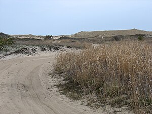
Napeague State Park
|
Napeague State Park
|
||
|
Dunes in Napeague State Park |
||
| location | East Hampton ; Suffolk County , New York State , United States | |
| Geographical location | 40 ° 59 ' N , 72 ° 5' W | |
|
|
||
| Setup date | 1978 | |
| administration | New York State Office of Parks, Recreation and Historic Preservation | |
Napeague State Park is a state park in the area of the town of East Hampton in Suffolk County , New York . The park is undeveloped, it stretches across the full width of the South Fork of Long Island from the Atlantic to Gardiners Bay and Block Island Sound . It covers an area of 1364 acres (5.52 km²) along the Montauk Highway ( New York State Route 27 ) on the "Napeague Stretch" between Amagansett and Montauk . The village of Napeague is on the edge of the park.
history
The grounds for Napeague State Park were originally acquired by the Nature Conservancy in 1976 and given to New York State in 1978 . It consists mainly of wetlands and areas that were hit by the surf during the New England Hurricane (1938) .
geography
There are no camping facilities in the park and park management is provided by nearby Hither Hills State Park . The most important scenic feature is the pristine beach on the Atlantic Ocean, which is closed in summer because the endangered yellow-footed plover nests there.
A landmark in the park is the large abandoned Smith Meal Fish Factory in an area of Gardiners Bay called Promised Land . There is a dispute over this because Cross Sound Ferry has proposed that the Promised Land Terminal should offer a ferry service across Long Island Sound to New London , Connecticut . So far there is no connection from the South Fork of Long Island to Connecticut and to the popular Foxwoods and Mohegan Sun casinos. The only ferry service on the east end of Long Island runs from Orient Point on the North Fork . However, the Town of East Hampton has so far successfully fended off every offer of a ferry connection.
See also
Individual evidence
- ^ Geographic Names Information System . United States Geological Survey.
- ^ Section O: Environmental Conservation and Recreation, Table O-9 . In: 2014 New York State Statistical Yearbook . The Nelson A. Rockefeller Institute of Government, 2014, p. 673 (Retrieved March 6, 2016).
- ↑ Napeague State Park (New York-New Jersey-Connecticut Botany Online)

