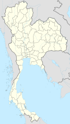
Narathiwat
|
นราธิวาส Narathiwat |
||
|---|---|---|
|
|
||
| Coordinates | 6 ° 26 ′ N , 101 ° 50 ′ E | |
| Symbols | ||
|
||
| Basic data | ||
| Country | Thailand | |
| Narathiwat | ||
| ISO 3166-2 | TH-96 | |
| Residents | 41,298 (2012) | |
Narathiwat ( Thai : นราธิวาส ) is the capital of the Thai province of Narathiwat . It has the status of a Thesaban Müang ( เทศบาล เมือง นราธิวาส ; "City Commune").
The city of Narathiwat has 41,298 inhabitants. (Last updated 2012)
geography
Narathiwat is located at the mouth of the river (Mae Nam) Bang Nara in the South China Sea , in the extreme south of Thailand . The city is surrounded by the foothills of the Tenasserim Mountains . The distance to the capital Bangkok is 1150 kilometers. By contrast, it is less than 40 kilometers to the Malaysian border.
Economy and Importance
The main product of intensive agriculture is the coconut . The fruits are thrown from the tree by specially trained monkeys.
traffic
Airport
The Narathiwat Airport is about 15 kilometers northwest of the provincial capital of Narathiwat.
history
Narathiwat emerged from a Malay village called Menara ( Malay منارة ' minaret ' ). Until 1809 this belonged to the autonomous, but Siam tributary Sultanate of Patani . After its defeat by the Siamese King Rama I , Menara belonged to the semi-autonomous province of Mueang Sai Buri . It was not until 1906 - during the reign of King Chulalongkorn (Rama V) - that the Siamese central administration (Thesaphiban) was introduced here. In the following year Menara, which by then had the Thai name Bang Nara , became the capital of its own province.
After the Anglo-Siamese Treaty of 1909, today's Narathiwat remained in Siam (Thailand), while the nearby sultanate of Kelantan came under British protectorate as part of the Unfederated Malay States . Since then, the border has run almost 40 km southeast of Narathiwat - at that time between Siam and the British colonial empire - today between Thailand and Malaysia. Nevertheless, there are still close cultural relationships with the neighboring Malay regions, for example the Malay dialect Yawi spoken in Narathiwat is very similar to the dialect of Kelantan.
In 1915, King Vajiravudh (Rama VI) renamed the city and province of Bang Nara to Narathiwat (derived from Sanskrit nara-adhivasa , "place of residence of the good / wise people"). In Malay usage the city is still called Menara. Narathiwat belongs to the area of activity of Muslim-Malay separatists who are calling for an affiliation to Malaysia or the independence of a sultanate of Patani.
Attractions
- The cityscape is shaped by the influence of the Malays and the Chinese , a different flair than in the Thai heartland. The onion domes of the mosques tower high everywhere, including the “old central mosque” (Matsayit Klang Kao) , the “provincial mosque ” (Matsayit Changwat) and the 300-year-old Wadin Hussein mosque.
- Narathat beach on the offshore peninsula and public park of the city of Narathiwat, which extends around a pond.
- The Ao Manao – Khao Tanyong National Park (approx. 5 km east of the city center) is one of Thailand's smaller national parks with an area of 58.6 km². The protected coastal landscape includes a 4-kilometer stretch of beach with scattered rocks, a strip of pine trees and an arboretum as well as Tanyong Mountain, which is covered with dense forest.
- Thaksin Ratchaniwet ("South Palace") - Palace on Mount Tanyong in Tambon Kaluwo Nuea, about 8 km outside the center of Narathiwat; the palace is the summer residence of the royal family and was built in 1973 for King Bhumibol Adulyadej (Rama IX).
- Royal Center for Development Studies Phikun Thong - Regional Agricultural Development Center with an area of more than 270 hectares in Tambon Kaluwo Nuea, approx. 8 km southeast of the city center; Here, plant varieties are tested for their cultivability and rearing methods for cattle.
Personalities
- Airfan Doloh (* 2001), soccer player
- Nihafil Hayi-arsan (born 1997), football player
Individual evidence
- ↑ Department of Provincial Administration : As of 2012 (in Thai)
- ↑ ThinkNet: Thailand MapMagic CD + Paper Map. Multi-Purposes Bilingual Mapping Software . Bangkok, 2009 edition, ISBN 978-974-88247-9-6 .
Web links
- City map of Narathiwat (names in English and Thai) [last accessed on November 17, 2013]
- Official website of the Ao Manao-Khao Tanyong National Park (in English)

