Carara National Park
| Carara National Park | ||
|---|---|---|
| Entrance to the Carara National Park | ||
|
|
||
| Location: | Puntarenas , Costa Rica | |
| Surface: | 52 km² | |
| Founding: | 1998 | |
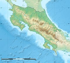
The Carara National Park ( carara means crocodile in the language of the Huetar Indians ) is located on the Costanera Sur coastal road on the Pacific coast of Costa Rica . It was declared a Carara Biological Reserve in 1978 and a National Park in 1998.
The national park is about 90 kilometers from the capital San José and about 80 kilometers from the Manuel Antonio National Park further south .
The site begins on the banks of the Río Tárcoles river , has an area of about 4700 hectares and includes five vegetation zones. Most of the park consists of dense primary forest , with dry forest in the northern part and rainforest in the southern part . This is why the area is also known as a transition forest. The annual rainfall is about 3000 millimeters.
Special representatives of fauna are pointed crocodiles on the banks of the River Tárcoles and the endangered Scarlet Macaws (Scarlet Macaw), whose main breeding is the national park. Furthermore, one finds anteaters , agoutis , ocelots , spider monkeys , poison dart frogs and about 20 different kinds of poisonous snakes and spoonbills , storks , darters , trogons , motmots and toucans .
In the park there are about 15 sites from 2000 years of Indian history, so that it is also of interest to archaeologists.


