Irazú
| Irazú | ||
|---|---|---|
|
Irazú volcano with acid lake and Gunnera insignis at the crater rim |
||
| height | 3432 m | |
| location | Costa Rica | |
| Coordinates | 9 ° 58 '37 " N , 83 ° 51' 15" W | |
|
|
||
| Type | Stratovolcano | |
| Last eruption | 1994 | |
|
Irazú volcano without acid lake in 2015 |
||
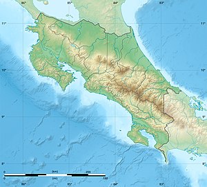
The Irazú , in the indigenous language Iaratzu ("rumbling mountain"), is the highest volcano in Costa Rica with 3432 m . The stratovolcano (stratovolcano) is one of the most dangerous and unpredictable volcanoes in the country.
It erupted for the last time in 1994 with a level 2 on the volcanic explosive index (VEI). There was an eruption of magnitude 3 in 1963. During this eruption phase, which lasted until 1965, steam clouds laden with lava dust and stones shot up to 500 meters high into the sky.
If there was another eruption, its ash clouds could reach the densely populated capital of this Central American country, San José .
The volcano is one of those that have a rain-fed acid lake in their crater lake . It is green in color. The dangers posed by this volcano primarily concern a landslide on the thin crater wall. Then several million tons of rock would slide off and the acid lake would flow out.
A special feature of this volcano is that on a clear day you can see two seas , the Caribbean Sea and the Pacific Ocean , from its top .
literature
- Fiction
- Christoph Ransmayr : Pacífico, Atlántico. Costa Rica , in: Atlas of a Fearful Man . S. Fischer, Frankfurt am Main 2012, p. 294ff.
Web links
- Irazú in the Global Volcanism Program of the Smithsonian Institution (English)


