Manuel Antonio National Park
| Manuel Antonio National Park | ||
|---|---|---|
| View of the Pacific and the islands of the Manuel Antonio National Park | ||
|
|
||
| Location: | Puntarenas , Costa Rica | |
| Next city: | Quepos | |
| Surface: | 6.82 km² | |
| Founding: | November 15, 1972 | |
| Address: | www.manuelantoniopark.com | |
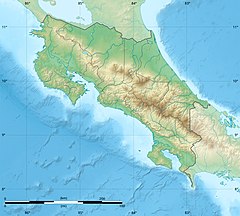
The settlement of Manuel Antonio and the associated Manuel Antonio National Park are located on the Pacific coast in southern Costa Rica , seven kilometers south of Quepos .
At seven square kilometers, the national park is the smallest national park in Costa Rica and includes both the palm forests on the Pacific and twelve small islands off the coast. He is known for his many, not shy animals. In addition to over 350 different plant species, there are 109 different mammal species, for example sloths , white-nosed coatis , capuchin monkeys and armadillos . Almost all reptiles on the Costa Rica Pacific coast can be found there. For example, fully grown black iguanas can be observed at close range. There are several public beaches in the park where you can snorkel. You have the opportunity to observe a large number of fish species.
In general, warnings are given against touching all animals and plants. Among other things, there are poisonous manzanilla trees there .
Individual evidence
- ↑ Archived copy ( memento of the original from July 26, 2016 in the Internet Archive ) Info: The archive link was inserted automatically and has not yet been checked. Please check the original and archive link according to the instructions and then remove this notice.


