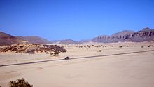
National Road 1 (Algeria)
The national road 1 or N1 for short is a trunk road in Algeria and runs in a north-south direction. Its northern end point is in the port city of Algiers on the Mediterranean Sea , the southern end is on the border with Niger . With a length of over 2300 km, it is the longest continuous road link in Algeria and part of the Algiers-Lagos highway .
course
The first section from Algiers to Laghouat has a length of 394 km. Up to the southwest of Blida , the N 1 is developed like a motorway. There the national road 4 branches off in a westerly direction. Via Medea and Berrouaghia , the route winds through the Tell Atlas to Ksar el-Boukharj . South of this town, the road emerges from the mountains, crosses national road 40 and reaches the town of Ain Oussera in the northeastern area of the Hauts Plateaux . The trunk road to Djelfa , the western end point of national road 46, runs via Hassi Bahbah . This is also where the Algiers – Djelfa railway ends , with an almost parallel route. Djelfa is located 1,282 meters above sea level on the northern edge of the Monts de Ouled Nail , on the road to Ain el Bell to be crossed before the route to the southwest by the Saharan Atlas the city Laghouat at a height of 792 m reached, the eastern terminus of the National road 23 .
The 218 km long section between Laghouat and the junction of national road 49 southeast of Ghardaia forms part of the main road connection between the western Mediterranean coast with the port city of Oran and the eastern Great Erg . In this section the road leads through the towns of Tilrempt and Berriane .
On the 245 km long section between the junction with the N 49 and El Ménia, there are just a few oases with Hassi Fahl , Gouiret Moussa and Hassi Saflet Iniguel .
The national road 61 branches 63 km south of El Menia and leads to approximately 250 km to the west in a similar unidirectional National Road 6 , which from Oran to Mali leads. The section to In Salah across the Plateau du Tademaït is 400 km long.
From here it is around 1000 kilometers to the Nigerien state border north of Assamaka . The route leads over Arak and Tamanrasset , touching the Ahaggar Mountains on the western edge.

