New York State Route 18F

|
|
|---|---|
| map | |

|
|
| Basic data | |
| Overall length: | 9.80 mi. / 15.77 km |
| Opening: | 1930 |
| Starting point: |
|
| End point: |
|
| County: | Niagara County |
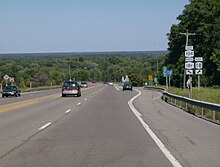
New York State Route 18F is a 15.77 km state route in northwest Niagara County , New York . The southernmost point of the route is the junction with New York State Route 104 and the Robert Moses State Parkway east of the Village of Lewiston . The northern terminus is the junction with New York State Route 18 near Four Mile Creek State Park in Porter . NY 18F runs largely parallel to NY 18, but takes a more westerly course. NY 18F is the only remaining branch route of NY 18 and was once part of this State Route itself.
Route description
Officially, NY 18F begins on the eastern edge of Lewiston at the junction between NY 104 and Robert Moses State Parkway. However, the signs for NY 18F exist further south at the intersection between NY 104 and NY 18 south of the village. NY 18F and NY 104 are signposted from NY 18 north to the intersection with Moses Parkway. The Seaway Trail , which runs along NY 104 from Niagara Falls towards Lewiston, follows NY 18F west into Lewiston on the stretch of Ridge Road , here called Center Street. On 4th Street, NY 18F turns north and follows the street to the intersection with Oneida Street. NY 18F will then turn left and walk two blocks on Oneida Street before heading north again out of town on 2nd Street.
North of the city limits, NY 18F is the closest street to the Niagara River - this is reflected in the street name, Lower River Road. On the way north on the east bank of the river, NY 18F runs parallel to Robert Moses State Parkway and NY 18. In Stella Niagara, NY 18F meets Fletcher Road, the first street north of Lewiston to connect these three highways. NY 18F then runs through the western edge of Joseph Davis State Park south of Youngstown in the Town of Porter . In Youngstown, NY 18F forms Main Street and crosses the western terminus of New York State Route 93 in the center of the village . On the northern edge of the settlement, NY 18F leads past the south entrance to Fort Niagara State Park , which the State Route leaves behind. NY 18F runs through Jackson Street and then north on Lake Road past the park.
Near the shores of Lake Ontario, NY 18F crosses the branch line of the Robert Moses State Parkway leading to Fort Niagara through an incomplete junction that can only be driveway to the west; access to the eastbound carriageway is via NY 93 in Youngstown or via NY 18 further east. After the driveway, NY 18F swings east and runs along the lakeshore. The State Route then turns south again, crosses the parkway, and ends at NY 18 near Four Mile Creek State Park in Porter.
The section between Center Street in Lewiston and Youngstown is maintained by Niagara County as County Road 907.
history
Today's NY 18F was once signposted as NY 34 between Lewiston and Youngstown . When renumbered in 1930, NY 34 became part of a much expanded NY 18, which followed the course of today's NY 18F. In 1949, the course of NY 18 was rearranged and the current route between Lewiston and Porter was established, while the route on the river became NY 18F.
NY 18F is the only remaining branch of NY 18. Originally, when New York State Route 18 reached Pennsylvania , State Routes 18A to 18D were assigned branches south of Lewiston, while New York State Route 18E was a branch within Lewiston was, which connected the village with the then Lewiston – Queenston Bridge . When NY 18 was cut to the Lewiston section at the beginning of the 1960s, NY 18A to NY 18D were either renumbered or incorporated into state routes that existed at the time. NY 18E in Lewiston was removed from the street directory when the original Lewiston-Queenston Bridge was demolished.
Individual evidence
- ↑ Traffic Data Report - NY 15 to NY 23 ( English , PDF) NYSDOT . July 16, 2007. Retrieved February 10, 2009.
- ^ Lewiston, NY - Google Maps . Retrieved February 10, 2009.
- ^ Porter, NY (south) - Google Maps . Retrieved February 10, 2009.
- ↑ Youngstown, NY - Google Maps ( English ) Retrieved on 10 February, 2009.
- ↑ Porter, NY (north) - Google Maps ( English ). Retrieved February 10, 2009.
- ↑ Niagara County Roads ( English ) Archived from the original on 20 December 2007. Retrieved on 10 February, 2009.
- ↑ New York's main highways designated by Numbers (English) . In: New York Times , December 21, 1924, pp. XX9.
- ^ Leon A. Dickinson: New Signs for State Highways (English) . In: New York Times , Jan 12, 1930, p. 136.
- ↑ a b Shell (1935). Ontario [map]. Cartography by HM Gousha Company . Retrieved October 1, 2012.
- ^ Shell (1949) (in English). Ontario [map]. Cartography by HM Gousha Company . Retrieved October 1, 2012.
- ^ New York Routes - New York State Route 18A ( English ) Retrieved February 10, 2009.
- ↑ Official map of Pennsylvania ( English ) Pennsylvania Department of Highways . 1960. Retrieved February 10, 2009.
- ↑ a b United States Geological Survey (1962) (in English). Topographic map of NY - Lewiston [map]. Archived from the GeoPDF original on (April 8, 2013). Retrieved October 1, 2012.

