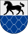
Nordanstig (municipality)
| Nordanstig municipality | |||||
|---|---|---|---|---|---|
|
|||||
| State : | Sweden | ||||
| Province (län): | Gävleborg County | ||||
| Historical Province (landskap): | Hälsingland | ||||
| Main place: | Bergsjö | ||||
| SCB code: | 2132 | ||||
| Residents : | 9477 (December 31, 2019) | ||||
| Area : | 1,455.3 km² (January 1, 2016) | ||||
| Population density : | 6.5 inhabitants / km² | ||||
| Website : | www.nordanstig.se | ||||
| List of municipalities in Sweden | |||||
Coordinates: 61 ° 59 ' N , 17 ° 4' E
Nordanstig is a municipality ( Swedish kommun ) in the Swedish province of Gävleborgs län and the historic province of Hälsingland . The main town of the municipality is Bergsjö .
The European route E 4 and the Gävle - Sundsvall railway line run through the municipality .
geography
The municipality stretches about 30 kilometers along the Baltic Sea coast and follows the course of the Harmångersån river and its tributaries about 70 kilometers to the northwest inland.
From the 10 km wide coastal plain, the municipality rises to what is initially largely bare hill country. The westernmost parts reach 500 meters above sea level and are forested.
history
The name Nordanstig is first mentioned in 1358 and became the name of the parish . Today's community was created in 1974 through the merger of four smaller communities.
economy
Economic life was previously shaped by forestry and the wood processing industry. Even today, 7% of the population work in agriculture and forestry (Reichs average 2%) and 30% in industry following forestry. Industrial locations are Gnarp, Hassela and Strömsbruk.
places
The following places are localities ( tatorter ):
Web links
- Official website (Swedish)
Individual evidence
- ↑ Folkmängd i riket, län och kommuner December 31, 2019 at Statistiska centralbyrån
- ↑ Kommunarealer January 1, 2016 at Statistiska centralbyrån (including all inland waters)


