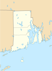
North Smithfield
| North Smithfield | ||
|---|---|---|
|
Location in Rhode Island
|
||
| Basic data | ||
| State : | United States | |
| State : | Rhode Island | |
| County : | Providence County | |
| Coordinates : | 41 ° 59 ′ N , 71 ° 33 ′ W | |
| Time zone : | Eastern ( UTC − 5 / −4 ) | |
| Residents : | 11,967 (as of 2010) | |
| Population density : | 192.1 inhabitants per km 2 | |
| Area : | 64.1 km 2 (approx. 25 mi 2 ) of which 62.3 km 2 (approx. 24 mi 2 ) are land |
|
| Height : | 110 m | |
| Postcodes : | 02824, 02896 | |
| Area code : | +1 401 | |
| FIPS : | 44-52480 | |
| GNIS ID : | 1219815 | |
| Website : | www.nsmithfieldri.org | |
North Smithfield is a city in Providence County , Rhode Island , United States .
geography
North Smithfield is located in the area of the historic Blackstone River Valley on the northern border of the state of Rhode Island, about three miles west of Woonsocket . The federal capital Providence is around 25 km away. The Rhode Island State Route 146 runs between Woonsocket and North Smithfield , here under the name North Smithfield Expressway .
The urban area has an area of 64.1 km², the mean height is 78 m above sea level. The Branch River runs through the city , and to the west of the city area is the Slatersville Reservoir , which consists of two partial lakes.
Due to the peculiarities of New England's administrative structure, there are several villages within the North Smithfield metropolitan area, including the historic villages of Forestdale , Primrose , Waterford , Branch Village , Union Village , Park Square and Slatersville .
population
The 2000 census counted 10,618 residents. More than 99% of the population were white . The per capita income was $ 25,031, with about 3% of the population living below the poverty line .
history
British colonists founded a settlement in what is now northern Rhode Island in the 17th century, which they named after the then independent town of Smithfield, now a district in north London . The settlement was part of Smithfield (Rhode Island) until the present city of North Smithfield was founded in 1871.
As in Pawtucket , located about 25 km downstream in the Blackstone River Valley , one of America's earliest industrial landscapes, the urban area of North Smithfield was characterized by the textile industry, which began with the building of textile mills and cotton mills by Samuel Slater , the first in 1793 successfully installed cotton spinning machine with a fully mechanized power transmission system in Pawtucket. Slater and his brother John founded Slatersville in 1803, with workers' houses and commercial buildings around a textile mill. Slatersville is said to be one of the first planned industrial mill settlements.
sons and daughters of the town
- Joseph O'Donnell (1925-2005), politician
- Jeff Jillson (born 1980), ice hockey player
Web links
- History of the State of Rhode Island with Illustrations. Hong, Wade & Co., Philadelphia 1878
