Northborough
| Northborough | ||
|---|---|---|
 |
||
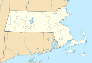
| Location in Massachusetts | ||
|
|
||
| Basic data | ||
| Foundation : | 1766 | |
| State : | United States | |
| State : | Massachusetts | |
| County : | Worcester County | |
| Coordinates : | 42 ° 19 ′ N , 71 ° 39 ′ W | |
| Time zone : | Eastern ( UTC − 5 / −4 ) | |
| Residents : | 14,155 (as of 2010) | |
| Population density : | 294.9 inhabitants per km 2 | |
| Area : | 48.6 km 2 (approx. 19 mi 2 ) of which 48.0 km 2 (approx. 19 mi 2 ) are land |
|
| Height : | 91 m | |
| Postal code : | 01532 | |
| Area code : | +1 508, 774 | |
| FIPS : | 25-46820 | |
| GNIS ID : | 0618375 | |
| Website : | www.town.northborough.ma.us | |
| Mayor : | John W. Coderre | |
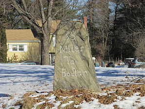
 Boston Post Road milestone |
||
Northborough is a small town ( Town ) in Worcester County in the US state of Massachusetts with almost 15,000 inhabitants on the Assabet River .
The place is about 15 kilometers east of Worcester and about 50 kilometers west of Boston on Interstate 495 . In the immediate vicinity are Berlin in the north and Marlborough in the east.
The 411.5 meter high Entravision Tower has stood two kilometers northwest in the municipality of Boylston .
In the first year of the Central United States' weather records (1787), Northborough is mentioned as the scene of the Four-State Tornado Swarm .
Personalities
- Elijah Brigham (1751-1816), politician
- John Davis (1787-1854), politician
- John Sullivan Dwight (1813-1893), transcendentalist, temporarily teacher in Northborough
Web links
Commons : Northborough, Massachusetts - Collection of pictures, videos, and audio files
