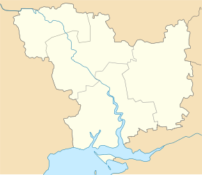
Novoswitliwka (Wesselynowe)
| Novoswitlivka | ||
| Новосвітлівка | ||

|
|
|
| Basic data | ||
|---|---|---|
| Oblast : | Mykolaiv Oblast | |
| Rajon : | Wesselynowe district | |
| Height : | 77 m | |
| Area : | 0.3261 km² | |
| Residents : | 1,410 (2001) | |
| Population density : | 4,324 inhabitants per km² | |
| Postcodes : | 57055 | |
| Area code : | +380 5163 | |
| Geographic location : | 47 ° 12 ' N , 31 ° 11' E | |
| KOATUU : | 4821783001 | |
| Administrative structure : | 1 village | |
| Address: | вул. Леніна 115 57 055 с. Новосвітлівка |
|
| Statistical information | ||
|
|
||
Novoswitliwka ( Ukrainian Новосвітлівка ; Russian Новосветловка Novoswetlowka , formerly German Rohrbach ) is a village in the Ukrainian Oblast of Mykolaiv with about 1400 inhabitants.
Geographical location
The village is located around 120 km north-northeast of Odessa , 23 kilometers southwest of the Wesselynowe district center and 67 kilometers northwest of the Mykolaiv oblast center. It extends on both sides of a valley, whereby the eastern part makes up around 3/4 of the village. North of the village is the source of the Zareha (Ukrainian Царега ), a 46 km long tributary of the Tylihul-Liman .
history
The settlement, which temporarily had up to 4,000 inhabitants, belonged to the Beresan colony and was founded in 1809 by German settlers under the name Rohrbach . The names of the surrounding villages such as Worms, Speyer and Rohrbach refer to the origins of the first generation of settlers, who came from the Palatinate, North Baden and Lower Alsace. In German times there was a school and an Evangelical Lutheran church. Both were destroyed by the Red Army in World War II, as was the German cemetery.
The architecture of the houses is the typical architecture in the Beresan area: Long, narrow houses, often over 15 m long, which are built orthogonally to the street and included stables for cattle in the rear.
After the Second World War, only a few new buildings were added except for a new school.
Attractions
There is a small museum in the school that deals with local history and takes into account the German, Soviet and, more recently, Ukrainian times. A four-volume, albeit still incomplete, directory with the fate of the colonists in the Berezan area was drawn up by the responsible oblast. In 2009, on the occasion of the 200th anniversary celebrations, a bilingual place-name sign was installed at the entrance to the town from the north.
Personalities
- Johannes Bonekemper (1795–1857), pastor from 1824 to 1848
- Karl Bonekemper (1827–1893), pastor from 1865 to 1876
See also
- Novoswitlivka , an urban-type settlement in Luhansk Oblast
Web links
- Website of locality (English)

