Oľka (river)
| Oľka | ||
|
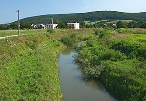
The Oľka near Žalobín |
||
| Data | ||
| location | Slovakia | |
| River system | Danube | |
| Drain over | Ondava → Bodrog → Tisza → Danube → Black Sea | |
| source | Laborecká vrchovina near Varechovce | |
| Source height | approx. 465 m | |
| muzzle |
Ondava at Žalobín coordinates: 48 ° 57 '43 " N , 21 ° 43' 18" O 48 ° 57 '43 " N , 21 ° 43' 18" O |
|
| Mouth height | 133 m | |
| Height difference | approx. 332 m | |
| Bottom slope | approx. 8.7 ‰ | |
| length | 38 km | |
| Catchment area | 225 km² | |
The Oľka is a 38 km long river in eastern Slovakia and a tributary of the Ondava .
It rises in the mountains Laborecká highlands on the western slope of Mount Šušková ( 516 m nm ) northwest of Varechovce , at an altitude of approximately 465 m nm it first flows south through Varechovce, Repejov , Oľka and Ruská Kajňa where the river its direction approximately corrected to the south-southwest. At Nižná Sitnica the Oľka takes up the right bank Sitnička, at Jasenovce the right bank Ondalík, before flowing into the Ondava as a left bank tributary behind Žalobín .
Web links
- Plán manažmentu povodňového rizika v čiastkovom povodí Bodrogu (PDF, 42.9 MB, Slovak, p. 57)
