Okotoks
| Okotoks | ||
|---|---|---|
 |
||
| Motto : Historic Past, Sustainable Future | ||
| Location in Alberta | ||
|
|
||
| State : |
|
|
| Province : | Alberta | |
| Municipal District: | Foothills No. 31 | |
| Coordinates : | 50 ° 44 ′ N , 113 ° 58 ′ W | |
| Height : | 1053 m | |
| Area : | 18.55 km² | |
| Residents : | 24,511 (as of 2011) | |
| Population density : | 1,321.3 inhabitants / km² | |
| Time zone : | Mountain Time ( UTC − 7 ) | |
| Postal code : | T1S | |
| Area code : | +1 403 | |
| Foundation : | 1904 | |
| Mayor : | Bill Robertson | |
| Website : | www.okotoks.ca | |
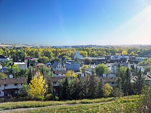
Okotoks is a small town in the Canadian province of Alberta . Located 18 km south of Calgary on the Sheep River , it has recently become a satellite town of Calgary.
The name Okotoks is derived from o'kotok , the word the black-footed Indians use to refer to Big Rock , one of the world's largest erratic boulders , which is located about 5 km west of the city. In the time before European settlement, the rocks were used by wandering Indians as a terrain marker to find a nearby river crossing.
The area was explored around the year 1800 by David Thompson , a Canadian cartographer and fur trader. A short time later trading stations were established, including one in 1874 at the river crossing over the Sheep River, on which the city of Okotoks is now located. The trading post was on a trading route called the Macleod Trail , which ran from Fort Benton in Montana to Calgary .
Web links
- Internet presence of Okotoks (English)

