Fort Benton
| Fort Benton | |
|---|---|
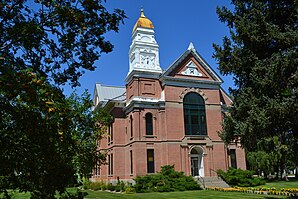
 Chouteau County Courthouse and Administration Building |
|
| Location of Fort Benton in Montana | |
| Basic data | |
| Foundation : | 1846 |
| State : | United States |
| State : | Montana |
| County : | Chouteau County |
| Coordinates : | 47 ° 49 ′ N , 110 ° 40 ′ W |
| Time zone : | Mountain ( UTC − 7 / −6 ) |
| Residents : | 1,594 (as of: 2000) |
| Population density : | 295.2 inhabitants per km 2 |
| Area : | 5.4 km 2 (approx. 2 mi 2 ) of which 5.4 km 2 (approx. 2 mi 2 ) is land |
| Height : | 799 m |
| Postal code : | 59442 |
| Area code : | +1 406 |
| FIPS : | 30-28000 |
| GNIS ID : | 1750122 |
| Website : | www.fortbenton.com |
Fort Benton is a small town in the US state of Montana and the administrative seat of Chouteau County . Part of the city has been a National Historic Landmark since 1961 . Founded in 1846 as a trading post, it was Senator Thomas Hart Benton of Missouri and was once an important port on the upper reaches of the Missouri River , the merchants and settlers from the river system of the Mississippi River served.
Fort Benton has a small, urban airport and the city has the only bridge over the Missouri River for more than 300 km. However, it has hardly any traffic significance because the southern river bank and its hinterland are practically unpopulated.
Fort Benton is home to the visitor center of the Upper Missouri River Breaks National Monument , which stretches for around 150 miles east of the town along the river.
Personalities
- Denise Curry (* 1959), basketball player
