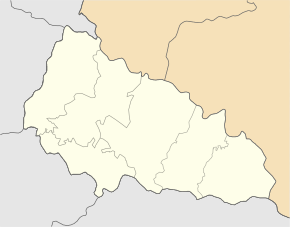
Oleschnyk
| Oleschnyk | ||
| Олешник | ||

|
|
|
| Basic data | ||
|---|---|---|
| Oblast : | Zakarpattia Oblast | |
| Rajon : | Vynohradiv district | |
| Height : | 124 m | |
| Area : | 9.095 km² | |
| Residents : | 4,696 (2004) | |
| Population density : | 516 inhabitants per km² | |
| Postcodes : | 90324 | |
| Area code : | +380 3143 | |
| Geographic location : | 48 ° 10 ' N , 22 ° 58' E | |
| KOATUU : | 2121283301 | |
| Administrative structure : | 1 village | |
| Address: | вул. Українська 193а 90324 с. Олешник |
|
| Statistical information | ||
|
|
||
Oleschnyk ( Ukrainian Олешник ; Russian Олешник Oleschnik , Slovak Olešník, Egreš , Hungarian Szőllősegres ) is a village in the Ukrainian Transcarpathian Oblast with about 4,700 inhabitants.
The village, first mentioned in 1284, is located in Carpathian Ukraine and shares its history .
Oleschnyk has a train station on the Borschawatalbahn and is the only village in the district council of the same name in Wynohradiv district in the border area with Romania and Hungary . The M 23 road runs 3 km south of Oleschnyk near Pidwynohradiv and the Rajon center Vynohradiv is 6 km southeast of the village.
Individual evidence
- ↑ Oleschnyk on the official website of the Verkhovna Rada , accessed on August 13, 2017 (Ukrainian)


