Ore (Leven)
| Ore | ||
|
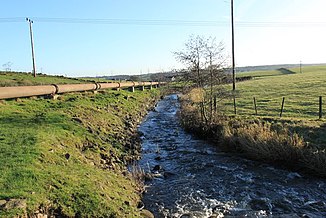
Upper course of the Ore |
||
| Data | ||
| location | Fife , Scotland | |
| River system | Firth of Forth | |
| Drain over | Leven → Firth of Forth → North Sea | |
| source | Drain from Loch Ore 56 ° 8 ′ 51 ″ N , 3 ° 19 ′ 56 ″ W. |
|
| muzzle | Between Glenrothes and Leven in the Leven Coordinates: 56 ° 11 ′ 25 " N , 3 ° 4 ′ 18" W 56 ° 11 ′ 25 " N , 3 ° 4 ′ 18" W
|
|
| length | 27 km | |
| Left tributaries | Lochty Burn | |
The Ore is a river in the Scottish council area of Fife . It arises as a drain of Loch Ore about halfway between Cowdenbeath and Loch Leven .
For the first hundred meters, the Ore flows in an easterly direction, but then turns south-southeast for a kilometer, and finally takes an east-northeast direction for most of its further course. It forms the border between the villages of Cardenden and Auchterderran and affects Thornton in the south. About one kilometer below Thornton, the Ore turns north for about one kilometer, then flows back to the north-northeast a few hundred meters after confluence with Lochty Burns , its main tributary. About one kilometer west of Windygates , the Ore flows into the Leven after a total of 27 km .
High iron concentrations are measured in the lower reaches of the Ore . This is due to the discharge of mine sewage into the Lochty Burn. The course of the Ores is crossed three times by railroad tracks, on which the Fife Circle Line runs today , and by the A92 .
