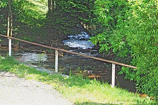
Orla (Little Roeder)
| Orla | ||
|
The Orla flows into the Kleine Röder in Ottendorf-Okrilla |
||
| Data | ||
| Water code | DE : 538446 | |
| location | Bautzen district , Saxony , Germany | |
| River system | Elbe | |
| Drain over | Kleine Röder → Große Röder → Schwarze Elster → Elbe → North Sea | |
| source |
Wachau (Saxony) 51 ° 8 ′ 32 ″ N , 13 ° 55 ′ 12 ″ E |
|
| Source height | approx. 255 m | |
| muzzle | in the lower village of Ottendorf-Okrilla in the Kleine Röder Coordinates: 51 ° 11 ′ 16 ″ N , 13 ° 49 ′ 59 ″ E 51 ° 11 ′ 16 ″ N , 13 ° 49 ′ 59 ″ E |
|
| Mouth height | 175 m | |
| Height difference | approx. 80 m | |
| Bottom slope | approx. 8 ‰ | |
| length | 10 km | |
Orla , also Orla-Graben and popularly in the upper reaches also Wachau Dorfbach or Saugraben , is the name of the approx. 10 km long brook that rises on the Wachau at about 255 m height on the northern edge of the Landwehr . The approximately one hectare Landwehrteich is fed from two source streams, from which the Orla then flows northwards towards the Wachau.
It flows into the lower village of Ottendorf-Okrilla at 175 meters above sea level. HN in the Kleine Röder . The Orla is dammed up to ponds in several places, especially within the Wachau area. a. The moat that completely surrounds the Wachau baroque castle and the Wachau castle pond (church pond) are also fed by the Orla.
As the fishing waters of the DAV ( German Anglers Association ), the Orla is listed under the water number D 07-08 over a length of 5 km from the municipality of Wachau to the confluence with the Kleine Röder. The Landwehr pond , the Wachau village pond, the Fünfhufenteich and the sand pond (however not fed by the Orla) are DAV waters and are managed by the local association "Rödertal Radeberg". The Orla is considered a trout water.
See also
literature
- Dresdner Heide, Pillnitz, Radeberger Land (= values of our homeland . Volume 27). 1st edition. Akademie Verlag, Berlin 1976, p. 29.
