
Ottendorf-Okrilla
| coat of arms | Germany map | |
|---|---|---|

|
Coordinates: 51 ° 11 ′ N , 13 ° 50 ′ E |
|
| Basic data | ||
| State : | Saxony | |
| County : | Bautzen | |
| Height : | 180 m above sea level NHN | |
| Area : | 25.93 km 2 | |
| Residents: | 9980 (Dec. 31, 2019) | |
| Population density : | 385 inhabitants per km 2 | |
| Postal code : | 01458 | |
| Area code : | 035205 | |
| License plate : | BZ, BIW, HY, KM | |
| Community key : | 14 6 25 430 | |
| LOCODE : | DE OOK | |
| Community structure: | 4 districts | |
| Address of the municipal administration: |
Radeburger Str. 34 01458 Ottendorf-Okrilla |
|
| Website : | ||
| Mayor : | Michael Langwald (independent) | |
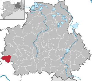
| Location of the municipality of Ottendorf-Okrilla in the Bautzen district | ||
  |
||

Ottendorf-Okrilla is a municipality in the Bautzen district in Saxony . With around 10,000 inhabitants, Ottendorf-Okrilla is the sixth largest municipality in the district and its largest municipality without municipal rights .

geography
Geographical location
Ottendorf-Okrilla is located in the far west of the Bautzen district and is approximately 20 kilometers northeast of Dresden city center . In the north the community borders on the Laußnitzer Heide , in the south on the Große Röder . The north-south extension of the municipality is about six kilometers, the east-west extension about seven. It has an area of 2588 hectares, of which 158 hectares are used commercially.
Neighboring communities


Adjacent municipalities are:
- Dresden with the districts Lausa and Marsdorf within the village of Weixdorf
- Großdittmannsdorf (district of Radeburg ) in the district of Meißen as well
- Laußnitz and Wachau in the Bautzen district.
Local division
The community is divided into the districts Grünberg ( ⊙ , with Diensdorf ), Hermsdorf ( ⊙ , often Hermsdorf near Dresden ), Medingen and the main town Ottendorf-Okrilla, which in turn is made up of the towns Ottendorf , Moritzdorf , Großokrilla , Kleinokrilla and Cunnersdorf , but which have no district status.
history
Okrilla is a Slavic word and means "round village". Round villages were typical of Slavic villages. Okrilla is therefore much older than Ottendorf, which was founded after 1200. The place name Ottendorf is a combination of the personal name Otto and village.
Ottendorf was first mentioned in a diocese article in 1346 under Margrave Friedrich II (the Serious) .
In 1846, today's Radeberger Strasse in Ottendorf-Okrilla was expanded as a permanent road. This road was an important trade route. Glass was transported from Bohemia to Prussia on the “Bohemian Glass Road” . At the same time, this was also an important "salt road" through which the salt was transported from Halle to Bohemia and Silesia . In 1849 a flour mill was built between Cunnersdorf and Medingen . Bread was also baked and sold here.
The first glassworks was opened in 1865 . The glassworks was located on Königsbrücker Strasse, across from today's restaurant "Zum Goldenen Ring". Other glass works in the area were the Brockwitz glassworks (founded in 1898) and the Grohmann glass refinery (founded in 1893), all of which no longer exist today. A sawmill was also opened in 1865 . The steam cutting mill processed the wood from the Laußnitzer Heide .
Since October 1884 the railway has been running on the spot. A narrow-gauge railway connected Königsbrück with Dresden-Klotzsche and ran via Ottendorf-Okrilla. In 1897 the narrow-gauge railway was converted into a standard-gauge line. This was an important location advantage for the industrialization of the place. In 1885 799 tons of goods were transported. In the following years, the transport of goods increased enormously. In 1865 the first cabinet maker was founded. The possibility of obtaining the wood inexpensively on site led to the creation of further furniture workshops in the area. The first hard coal works went into operation in 1909. This made it possible for the first time to install public street lighting.
In the period before the First World War , there was a great economic boom. Ottendorf-Okrilla became an industrial and workers' residential community. During the war, however, all available resources were invested in warfare. Private housing construction stagnated and in 1920 there was an extreme housing shortage, which is why new houses were built on the new street "Siedlung". The Pulnitz power station has been supplying the town with electricity since 1922. From 1926 gravel was mined commercially . From 1927 the construction of a central drinking water supply began.
After slumps caused by the global economic crisis , the economic situation improved from 1933.
At the beginning of the Nazi era , there were serious attacks in March 1933. SA men set up a stake in front of the “Zum schwarzen Roß” inn and tortured opponents of the regime who had been arrested there. They abuse the handicapped communist Josef Hannemann particularly brutally. During the GDR era, a memorial plaque for him was placed on the house at Radeberger Strasse 12. The building used as a cultural center also bore his name until it was demolished after 1990 due to increasing structural deterioration.
After the end of the Second World War , some Russian soldiers were billeted.
In the time of the GDR the place became more and more an industrial location. In addition to the glassworks, the gravel pit, the timber trade and the charcoal burning, new companies were added, for example plastics processing. The German reunification brought a structural change with it. Many companies had to close after reunification , so u. a. also the glass factory, the furniture factory and a little later the concrete factory. Some businesses (including plastic processing) were sold and at least partially survived privatization by the Treuhandanstalt.
In 1991 the Ottendorf-Okrilla industrial park was built, which significantly changed the appearance of the community. In addition, new living space was built.
Incorporations
On October 24, 1911, the municipalities of Ottendorf b. Medingen and Moritzdorf to Ottendorf-Moritzdorf. In 1920 Cunnersdorf b. Medingen was incorporated into the Ottendorf-Moritzdorf community, followed exactly one year later by Kleinokrilla . Ultimately, on July 1, 1921, Großokrilla was incorporated and the new community was renamed Ottendorf-Okrilla at the same time . At the time of incorporation there were around 4500 inhabitants, and at the census of June 16, 1925, 4753 inhabitants. In the course of the Saxon community area reforms in the 1990s, Grünberg was incorporated on January 1, 1994 and Hermsdorf and Medingen on January 1, 1999, each on the basis of voluntary agreements.
Population development
(As of December 31st)
| year | 1998 | 2000 | 2002 | 2007 | 2009 | 2011 | 2012 | 2013 | 2014 | 2015 | 2016 |
|---|---|---|---|---|---|---|---|---|---|---|---|
| Residents | 10,253 | 10,343 | 10,273 | 10,076 | 9,920 | 9,826 | 9,861 | 9,892 | 9,935 | 9,941 | 9,971 |
Religions

- Protestant churches
- Ottendorf-Okrilla church
- Grünberg Church
- Medingen Church
- Hermsdorf Palace Chapel
- Catholic churches
- Free church communities
- Evangelical Free Church Congregation Ottendorf-Okrilla
- Christ Center Ottendorf-Okrilla ( Pentecostal Church )
politics
Municipal council
The 17 seats in the municipal council have been distributed as follows since the local elections on May 26, 2019 :
| Party / list | Seats | + / - |
| CDU | 6th | - 2nd |
| The left | 4th | ± 0 |
| AfD | 2 | + 2 |
| FDP | 2 | + 1 |
| Action alliance non-party (AP) | 3 | ± 0 |
mayor
The last mayoral elections took place on March 10, 2013. Incumbent Michael Langwald (proposed by LINKE, FDP and SPD) prevailed with 66.5% of the votes against the challenger Mirko Thomas (CDU). The turnout was 59.5%.
Attractions
The cultural monuments are listed in the list of cultural monuments in Ottendorf-Okrilla .
Furthermore, there has been a skater circuit in the industrial park since 2018, which was built as part of a school project.
Economy and Infrastructure

education
The community has three primary schools (one in Hermsdorf, one in Medingen) and one high school.
Business
In Ottendorf-Okrilla, there are around 6500 jobs in around 700 companies in addition to the mail and parcel centers of Deutsche Post AG . During the GDR era there was a large press shop for plastic parts on site.
traffic


Ottendorf-Okrilla is located north of the BAB 4 on the B 97 . The community can be easily reached via the Hermsdorf and Ottendorf-Okrilla motorway junctions.
In addition, the community is connected to the Dresden – Königsbrück railway line . The following train stations and stops exist in the municipality:
- Hermsdorf stop (near Dresden)
- Ottendorf-Okrilla Süd train station
- Ottendorf-Okrilla stop
- Ottendorf-Okrilla Nord station

Trivia
On March 4, 1959 at 1:51 p.m., the first and only type 152 / V1 aircraft , license plate DM-ZYA developed by the GDR, crashed 5.70 km from the runway of Dresden Airport near Ottendorf-Okrilla on its second test flight . All four crew members died.
One of the rare dodecagon houses stands in Ottendorf-Okrilla , an example of GDR architecture from the 1970s.
Personalities
- Fried Walter (1907–1996), composer, born in the community
- Walter Prescher van Ed (1916–1988), painter, died in the community
- Friedbert Groß (* 1937 in Medingen), music teacher, composer and politician (CDU)
- Thea Richter (* 1945), sculptor, born in the community
- Knut Großmann (1949–2016), engineer and university professor, born in the community
literature
- Dresdner Heide, Pillnitz, Radeberger Land (= values of our homeland . Volume 27). 1st edition. Akademie Verlag, Berlin 1976, p. 24.
- Karl Gottlieb Dressler: Chronicle of the parish Ottendorf and the villages Lausa, Hermsdorf, Grünberg and Cunnersdorf according to reliable sources . Meissen 1890 ( digitized version )
Web links
- Ottendorf-Okrilla municipality (official website)
- Ottendorf-Okrilla in the Digital Historical Directory of Saxony
- Website of the district Medingen
Individual evidence
- ↑ Population of the Free State of Saxony by municipalities on December 31, 2019 ( help on this ).
- ↑ z. E.g .: stop timetable - stop Hermsdorf b Dresden, Hermsdorf (b Dresden). (No longer available online.) Formerly in the original ; Retrieved May 1, 2010 . ( Page no longer available , search in web archives ) Info: The link was automatically marked as defective. Please check the link according to the instructions and then remove this notice.
- ↑ a b c d e K. G. Dreßler: In: Chronik der Parochie Ottendorf and the villages Lausa, Hermsdorf, Grünberg, Cunnersdorf , 1890
- ↑ a b c d e f g Moritz Endler: In: Chronik der Gemeinde Ottendorf-Okrilla , 1934
- ^ Bund der Antifaschisten, Region Dresden eV: Radeberger Land under the swastika. In: http://aardb.blogsport.de/images/RadebergerLandunterdemHakenkreuz.pdf . Authors group headed by Professor Dr. Helfried Wehner, accessed on August 31, 2018 .
- ↑ Municipalities 1994 and their changes since January 1, 1948 in the new federal states , Metzler-Poeschel publishing house, Stuttgart, 1995, ISBN 3-8246-0321-7 , publisher: Federal Statistical Office
- ↑ StBA: Changes in the municipalities in Germany, see 1999
- ↑ Population of the Free State of Saxony at the end of each month for selected reporting months by municipality. Retrieved January 13, 2020 .
- ↑ Internet presence of the parish-church facilities , accessed on April 29, 2015
- ↑ Statistics Saxony - Election results local elections 2019 - Ottendorf-Okrilla , accessed on July 25, 2019
- ^ Result of the mayoral election 2013 in Ottendorf-Okrilla
- ↑ Skate circuit - Ottendorf-Okrilla community. Retrieved December 25, 2018 .

Cities:
Bautzen (Budyšin) |
Bernsdorf (Upper Lusatia) |
Bischofswerda |
Elstra (Halštrow) |
Großröhrsdorf |
Hoyerswerda (Wojerecy) |
Kamenz (Kamjenc) |
Koenigsbrück |
Lauta |
Pulsnitz |
Radeberg |
Schirgiswalde-Kirschau |
Weißenberg (Wóspork) |
Wilthen |
Wittichenau (Kulow)
Municipalities:
Arnsdorf |
Burkau (Porchow) |
Crostwitz (Chrósćicy) |
Cunewalde |
Demitz-Thumitz |
Doberschau Gaussig (Dobruša Huska) |
Elsterheide (Halštrowska hola) |
Frankenthal |
Göda (Hodźij) |
Großdubrau (Wulka Dubrawa) |
Großharthau |
Großnaundorf |
Großpostwitz / OL (Budestecy) |
Haselbachtal |
Hochkirch (Bukecy) |
Königswartha (Rakecy) |
Kubschütz (Kubšicy) |
Laußnitz |
Lichtenberg |
Lohsa (Łaz) |
Malschwitz (Malešecy) |
Nebelschütz (Njebjelčicy) |
Neschwitz (Njeswačidło) |
Neukirch |
Neukirch / Lausitz |
Obergurig (Hornja Hórka) |
Ohorn |
Oßling (Wóslink) |
Ottendorf-Okrilla |
Panschwitz-Kuckau (Pančicy-Kukow) |
Puschwitz (Bóšicy) |
Räckelwitz (Worklecy) |
Radibor (Radwor) |
Ralbitz-Rosenthal (Ralbicy-Róžant) |
Rammenau |
Schmölln-Putzkau |
Schwepnitz |
Sohland on the Spree |
Spreetal (Sprjewiny Doł) |
Steina |
Steinigtwolmsdorf |
Wachau (Saxony)