
Ohorn
| coat of arms | Germany map | |
|---|---|---|

|
Coordinates: 51 ° 11 ' N , 14 ° 3' E |
|
| Basic data | ||
| State : | Saxony | |
| County : | Bautzen | |
| Management Community : | Pulsnitz | |
| Height : | 366 m above sea level NHN | |
| Area : | 11.99 km 2 | |
| Residents: | 2454 (Dec. 31, 2019) | |
| Population density : | 205 inhabitants per km 2 | |
| Postal code : | 01896 | |
| Area code : | 035955 | |
| License plate : | BZ, BIW, HY, KM | |
| Community key : | 14 6 25 410 | |
| LOCODE : | DE OHX | |
| Community structure: | 5 districts | |
| Address of the municipal administration: |
Municipal administration Ohorn Schulstr. 2 01896 Ohorn |
|
| Website : | ||
| Mayoress : | Sonja Kunze (independent) | |
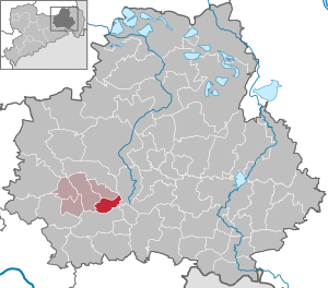
| Location of the municipality of Ohorn in the Bautzen district | ||
  |
||

Ohorn is a municipality in Saxony and part of the Pulsnitz administrative community .
Geography and traffic
The community is located about two kilometers southeast of Pulsnitz and 30 kilometers northeast of the state capital Dresden . The federal motorway 4 runs through the municipality and can be reached via the Ohorn connection . Ohorn is located on the foothills of the Westlausitzer Bergland , in the valley of the Pulsnitz , which also rises here on the western slope of the Tanneberg at about 360 meters above sea level. The Tanneberg is part of the Hochstein mountain range. The Hochstein itself reaches a height of 449 meters.
Local division
Ohorn consists of the districts:
- Fox bark
- Gickelsberg
- Mitteldorf
- Oberdorf
- Röderhäuser
History and Development
It was German knights around 1110 who called farmers and craftsmen from Thuringia, Hesse, Franconia and Bavaria to the area of the Pulsnitz valley. This created a small settlement about 20 hectares in size on the southwest slope of the Schleissberg . The Pulsnitz was considered an important source of life. The first documentary mention of the place took place in the year 1349 in the fief book of Friedrichs des Strengen as maple , the today's place name describes a "settlement to / near the maple tree or -wood".
In 1537 the Ohorner manor is mentioned as Vorwerk Pulsnitzer Herrschaft. Today only the manor house (in which a nursing home is housed) and some manor buildings converted into residential houses, as well as the park in the English style remain of the estate. Since the border between the Diocese of Meissen and the Kingdom of Bohemia ran through Ohorn, the place was exposed to the recurring war events and raids over the centuries. In addition, frequent epidemics reduced the population. In 1680 alone, a fifth of the Ohorn population died of the plague .
In 1661 the lordship of the manor approved the construction of a school house. The first school building to be used dates from around 1750. A fundamental social change began in Ohorn in 1745 after Michael Prescher introduced ribbon weaving in Ohorn. After 1800 Ohorn developed into an industrial place, which was also reflected in the population development. In 1885 there were already 2000 people living here.
The gymnastics club that still exists today was founded in 1865. In the same year a choral society was established, which no longer exists. In 1895 the compulsory fire brigade became the volunteer fire brigade Ohorn. The many new home weavers needed better machines, which is why the C. H. Schäfer company was founded in 1873, which at that time produced looms. Today this company produces industrial gears with a mass between 1 kg and 12.5 tons and is one of Ohorn's largest employers.
In 1827 and 1879 a larger schoolhouse was built in Ohorn. The blacksmith Bernhard Mocke created the first bus connection in 1912 when he built the first post bus in Saxony. The line connected the cities of Pulsnitz and Königsbrück . In 1925 the town hall was built from the Obergasthof. Five years later, the prayer room was built in the former steam mill of the manor. As early as 1939 Ohorn was connected to the motorway planned from Dresden to Wroclaw , today the federal motorway 4.
politics
Since the municipal council election on May 26, 2019 , the 14 seats of the municipal council have been distributed among the individual groups as follows:
- CDU : 5 seats (−1)
- Free List Sports (FLSp): 2 seats (−2)
- LEFT : 1 seat (−1)
- FDP : 2 seats (+1)
- Electoral association : 1 seat
- AfD : 3 seats (+3)
On September 22, 2013 Sonja Kunze (non-party) was elected as the new mayor with 66.9% of the valid votes. She replaced Frank Jäger (Free List Sport).
Worth seeing

- Schleißberg with Schleißbergbaude (closed)
- Schwedenstein with observation tower and mountain restaurant
- Tanneberg view with refuge
- Local museum
- Kirchlehn
- Buschmühlenteich (to the gondolas)
Economy and Infrastructure
Today there are still two producing farmers and an agricultural cooperative in Ohorn. There are only a few weaving mills left in the village.
education
The community of Ohorn has a primary school and a kindergarten .
Sons and daughters of the church
- Johann Christian Kayser (1750–1813), organ builder
- Jürgen Haufe (1949–1999), graphic artist and painter
literature
- Cornelius Gurlitt : Ohorn. In: Descriptive representation of the older architectural and art monuments of the Kingdom of Saxony. 35. Issue: Amtshauptmannschaft Kamenz (Land) . CC Meinhold, Dresden 1912, p. 258.
Web links
- http://www.ohorn-sachsen.de/
- http://ohorn.info/
- Ohorn in the Digital Historical Directory of Saxony
Individual evidence
- ↑ Population of the Free State of Saxony by municipalities on December 31, 2019 ( help on this ).
- ^ Ernst Eichler : Historical book of place names of Saxony. Volume II: M-Z. Akademie-Verlag, Berlin 2001, p. 132
- ↑ Product examples. CH Schäfer Getriebe GmbH, accessed on October 26, 2019 .
- ↑ Results of the 2019 municipal council elections

Cities:
Bautzen (Budyšin) |
Bernsdorf (Upper Lusatia) |
Bischofswerda |
Elstra (Halštrow) |
Großröhrsdorf |
Hoyerswerda (Wojerecy) |
Kamenz (Kamjenc) |
Koenigsbrück |
Lauta |
Pulsnitz |
Radeberg |
Schirgiswalde-Kirschau |
Weißenberg (Wóspork) |
Wilthen |
Wittichenau (Kulow)
Municipalities:
Arnsdorf |
Burkau (Porchow) |
Crostwitz (Chrósćicy) |
Cunewalde |
Demitz-Thumitz |
Doberschau Gaussig (Dobruša Huska) |
Elsterheide (Halštrowska hola) |
Frankenthal |
Göda (Hodźij) |
Großdubrau (Wulka Dubrawa) |
Großharthau |
Großnaundorf |
Großpostwitz / OL (Budestecy) |
Haselbachtal |
Hochkirch (Bukecy) |
Königswartha (Rakecy) |
Kubschütz (Kubšicy) |
Laußnitz |
Lichtenberg |
Lohsa (Łaz) |
Malschwitz (Malešecy) |
Nebelschütz (Njebjelčicy) |
Neschwitz (Njeswačidło) |
Neukirch |
Neukirch / Lausitz |
Obergurig (Hornja Hórka) |
Ohorn |
Oßling (Wóslink) |
Ottendorf-Okrilla |
Panschwitz-Kuckau (Pančicy-Kukow) |
Puschwitz (Bóšicy) |
Räckelwitz (Worklecy) |
Radibor (Radwor) |
Ralbitz-Rosenthal (Ralbicy-Róžant) |
Rammenau |
Schmölln-Putzkau |
Schwepnitz |
Sohland on the Spree |
Spreetal (Sprjewiny Doł) |
Steina |
Steinigtwolmsdorf |
Wachau (Saxony)