
Steina (Saxony)
| coat of arms | Germany map | |
|---|---|---|

|
Coordinates: 51 ° 12 ' N , 14 ° 3' E |
|
| Basic data | ||
| State : | Saxony | |
| County : | Bautzen | |
| Management Community : | Pulsnitz | |
| Height : | 337 m above sea level NHN | |
| Area : | 12.51 km 2 | |
| Residents: | 1627 (Dec. 31, 2019) | |
| Population density : | 130 inhabitants per km 2 | |
| Postal code : | 01920 | |
| Area code : | 035955 | |
| License plate : | BZ, BIW, HY, KM | |
| Community key : | 14 6 25 580 | |
| Community structure: | 2 districts | |
| Address of the municipal administration: |
Main street 64 01920 Steina (Saxony) |
|
| Website : | ||
| Mayor : | Sandro Bürger ( CDU ) | |
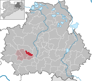
| Location of the municipality of Steina (Saxony) in the Bautzen district | ||
  |
||

Steina ( Upper Sorbian Sćenjow ) is a Saxon municipality in the Bautzen district and a member of the Pulsnitz administrative community .
geography
Steina is located about 30 kilometers north of Dresden , between Kamenz and Pulsnitz on the edge of the Lusatian mountains in the West Lusatia nature reserve . The place extends - as a typical row village with Waldhufenflur - more than 7 kilometers and divides into the suburbs Weißbach, Niedersteina and Obersteina. The Weißbach, a tributary of the Haselbach , flows through the village and flows into the Pulsnitz near Reichenau . What is striking for Steina is its structure close to the low mountain range, whereby the terrain is dominated by the Schwedenstein (approx. 420 m).
history
Steina was first mentioned in a document in 1349. Settlement began with the establishment of the colonist villages of Weißbach (originally Wysbach), Niedersteina (originally Nedirstein) and Obersteina (originally Oberstein). Compared to the neighboring communities, the foundation took place relatively late. Presumably, this also led to the fact that no separate parish was formed, but rather all church events from baptism to burial took place in the parish of Pulsnitz. Since its foundation, Weißbach, Niederstein and Obersteina were compulsory for the Pulsnitz manor lordship.
The communities Niedersteina and Obersteina, which were independent for centuries, grew together at the end of the 19th and beginning of the 20th century. The new houses were named Heaven . On July 1, 1950, the municipality of Steina was formed through the merger of the previously independent municipalities of Niedersteina and Obersteina. As a result, Steina was the largest rural community in what was then the Kamenz district with around 2150 inhabitants .
politics
Since the local elections in Saxony in 2019 , the 12 seats of the municipal council have been distributed among the individual groups as follows:
economy
For centuries the image of the individual communities was shaped by the rural hooves . The stony ground conditions, on which the place name is possibly based, brought the farmers only low yields. The need for more arable land pushed the forest back into areas that were unsuitable for agriculture. This created today's landscape with residual forest on hilltops and marshy valleys. A large closed forest area, the Luchsenburg Forest, remained to the south-east of the village area. In the course of the 18th century, the tape-making trade arose, which was mainly operated as a home weaving mill. Then came the stone industry, which developed strongly due to the increasing demand for building materials. Numerous remaining holes from which the granite was broken still testify to this today. In 1972, the mining operations in the last quarry, Hausein , ended.
Worth seeing
Due to its scenic location, Steina is a particularly good starting point for excursions and hikes. A special excursion destination is the Schwedenstein , whose observation tower, built in 1898, offers a very good panoramic view of Upper and West Lusatia. In winter, the slopes of the mountain offer good skiing conditions, not least thanks to a ski lift. On the road with the cycle path to Pulsnitz there is a Royal Saxon whole milestone from around 1860 from the Dresden - Camenz postal route , which was temporarily located in the park on Poststraße and in the town hall of Pulsnitz after being damaged in an accident.
Sports
Sport has played an important role in the recent history of the place. In 1885 the Obersteina gymnastics club was founded. In 1900 the Niedersteina cycling club followed. To date, the sport of handball has gained a good name.
Local division
The districts of the community are Weißbach, Niedersteina, Obersteina and the New Village.
Personalities
- Gottfried Herold (* 1929), writer, born in Weißbach
- Harry Herrmann (* 1930), Colonel of the MfS
Web links
- Homepage about Steina
- Steina in the Digital Historical Directory of Saxony
- Niedersteina in the Digital Historical Directory of Saxony
- Obersteina in the Digital Historical Directory of Saxony
- Weißbach in the Digital Historical Directory of Saxony
Individual evidence
- ↑ Population of the Free State of Saxony by municipalities on December 31, 2019 ( help on this ).
- ↑ Results of the 2019 municipal council elections

Cities:
Bautzen (Budyšin) |
Bernsdorf (Upper Lusatia) |
Bischofswerda |
Elstra (Halštrow) |
Großröhrsdorf |
Hoyerswerda (Wojerecy) |
Kamenz (Kamjenc) |
Koenigsbrück |
Lauta |
Pulsnitz |
Radeberg |
Schirgiswalde-Kirschau |
Weißenberg (Wóspork) |
Wilthen |
Wittichenau (Kulow)
Municipalities:
Arnsdorf |
Burkau (Porchow) |
Crostwitz (Chrósćicy) |
Cunewalde |
Demitz-Thumitz |
Doberschau Gaussig (Dobruša Huska) |
Elsterheide (Halštrowska hola) |
Frankenthal |
Göda (Hodźij) |
Großdubrau (Wulka Dubrawa) |
Großharthau |
Großnaundorf |
Großpostwitz / OL (Budestecy) |
Haselbachtal |
Hochkirch (Bukecy) |
Königswartha (Rakecy) |
Kubschütz (Kubšicy) |
Laußnitz |
Lichtenberg |
Lohsa (Łaz) |
Malschwitz (Malešecy) |
Nebelschütz (Njebjelčicy) |
Neschwitz (Njeswačidło) |
Neukirch |
Neukirch / Lausitz |
Obergurig (Hornja Hórka) |
Ohorn |
Oßling (Wóslink) |
Ottendorf-Okrilla |
Panschwitz-Kuckau (Pančicy-Kukow) |
Puschwitz (Bóšicy) |
Räckelwitz (Worklecy) |
Radibor (Radwor) |
Ralbitz-Rosenthal (Ralbicy-Róžant) |
Rammenau |
Schmölln-Putzkau |
Schwepnitz |
Sohland on the Spree |
Spreetal (Sprjewiny Doł) |
Steina |
Steinigtwolmsdorf |
Wachau (Saxony)