Ossuga (Wasusa)
|
Ossuga Осу́га |
||
|
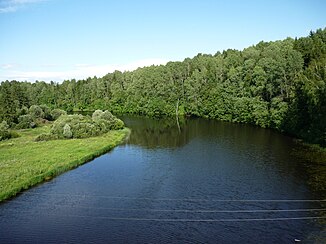
The Ossuga forms the border of the Tver and Smolensk Oblasts 4 km south of the village of Ossuga |
||
| Data | ||
| Water code | RU : 08010100312110000001357 | |
| location | Tver , Smolensk ( Russia ) | |
| River system | Volga | |
| Drain over | Wasusa → Volga → Caspian Sea | |
| source | in the village of Sawidowo in the southern Tver Oblast, 56 ° 8 ′ 27 ″ N , 33 ° 38 ′ 52 ″ E |
|
| muzzle | 3 km south of Werigino in the Wasusa dammed up to the Wasusa reservoir. Coordinates: 56 ° 4 ′ 51 ″ N , 34 ° 28 ′ 19 ″ E, 56 ° 4 ′ 51 ″ N , 34 ° 28 ′ 19 ″ E
|
|
| length | 100 km | |
| Catchment area | 1200 km² | |
| Drain |
MQ |
8.7 m³ / s |
| Right tributaries | Lussa , Rakitnja | |
| Reservoirs flowed through | Wasusa reservoir | |
The Ossuga ( Russian Осу́га ) is a 100 km long left tributary of the Wasusa in the European part of Russia .
description
The Ossuga rises in the village of Sawidowo , around 50 km west of Rzhev in the south of the Tver Oblast . From there it flows east and after a few kilometers it reaches the border of Smolensk Oblast , where it turns in southeastern directions. For a few kilometers, the border between the oblasts follows the course of the river.
South of the village of Ossuga , the Ossuga turns north-east and flows again in the area of Tver Oblast. About 15 km southwest of Subzow the Ossuga finally flows into the Wasusa reservoir ( Russian Вазузское водохранилище ) dammed Wasusa.
The river is frozen from mid-November to early April.
Web links
- Ossuga in Brockhaus-Efron - Encyclopedic Dictionary , quoted in the Russian online encyclopedia Академик / Akademik (russ.)
Individual evidence
- ↑ a b Ossuga in the State Water Directory of the Russian Federation (Russian)
- ↑ Ryschawski, G. Ja .: Бассейн верхней Волги (The Upper Volga Basin) . In: Физкультура и спорт , Moscow 1981 (Russian)
- ↑ a b c Ossuga in the Encyclopedia of Tver Oblast (Russian)
