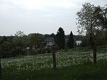
Osterholz (Schöller-Dornap)
|
Osterholz
City of Wuppertal
Coordinates: 51 ° 13 ′ 49 ″ N , 7 ° 2 ′ 26 ″ E
|
||
|---|---|---|
| Height : | 197 m above sea level NHN | |
| Incorporation : | 1975 | |
| Postal code : | 42327 | |
| Area code : | 0202 | |
|
Location of Osterholz in Wuppertal |
||
Osterholz is a district in the Vohwinkel district of the Bergisch city of Wuppertal in North Rhine-Westphalia / Germany .
Location and description
The district is located in the residential area of Schöller-Dornap south of Schöller on Kreisstraße 20, directly on the city limits of Haan . Neighboring places are Alt-Derken , Simonshöfchen , Bruckerthöhe (to Haan), Flachskamp (to Haan) and Bausenberger Busch (to Haan). The place is surrounded on three sides by the forest area of the same name, Osterholz .
To the east there was also a settlement called Osterholz at today's Kreisstrasse 20 in what is now the Osterholz residential area.
history
Osterholz is recorded for the first time on the maps of the Prussian first recording from 1843. The place became known at the end of the 19th century for a popular excursion restaurant called New America , which is still often used to denote the entire settlement. The restaurant was demolished in the 1950s because it was on the planned route of the federal highway 31 . However, these building plans were already rejected in the 1980s.
In 1975 the community of Schöller and the Wülfrath district of Dornap and their suburbs were split off from the Düsseldorf-Mettmann district and incorporated into Wuppertal as the Schöller-Dornap residential area. Osterholz came to Wuppertal from Schöller.
Web links
Individual evidence
- ^ Historika25, State Surveying Office NRW, sheet 4708, Elberfeld

