Oxford, Alabama
| Oxford | |
|---|---|
| Nickname : Crossroads To The Future | |
 Coldwater Creek Covered Bridge (2004) |
|
| Location in County and Alabama | |
| Basic data | |
| Foundation : | 1850 |
| State : | United States |
| State : | Alabama |
| Counties : |
Calhoun County Talladega County |
| Coordinates : | 33 ° 36 ′ N , 85 ° 50 ′ W |
| Time zone : | Central ( UTC − 6 / −5 ) |
| Residents : | 14,952 (as of: 2000) |
| Population density : | 316.8 inhabitants per km 2 |
| Area : | 47.4 km 2 (approx. 18 mi 2 ) of which 47.2 km 2 (approx. 18 mi 2 ) is land |
| Height : | 200 m |
| Postal code : | 36203 |
| Area code : | +1 256 |
| FIPS : | 01-57576 |
| GNIS ID : | 0160330 |
| Website : | www.oxfordalabama.org |
| Mayor : | Leon Smith |
Oxford is an American city in Alabama in the US state of Alabama. The city is partly in Calhoun County and partly in Talladega County . In 2004 the city had about 15,700 inhabitants according to the updates of the census.
geography
According to the United States Census Bureau , the city has an area of 47.4 km², of which 47.2 km² on land and 0.2 km² (= 0.38%) on water.
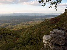
Oxford lies at the foothills of the Blue Ridge Mountains. The nearby Mount Cheaha is Alabama's highest point and allows a wide view of the city and its surroundings below the mountain. Much of the southern districts borders the Talladega National Forest .
Major bodies of water in the urban area include Oxford Lake, Lake Hillabee, and Choccolocco Creek, which splits the city in two.
history
Oxford, originally known as Lickskillet, was the first incorporated city in Calhoun County. It was founded in the early 1850s.
After 1970, Oxford incorporated larger areas in the south of the city into the urban area, including Coldwater and Bynum . Today, the city not only extends into Calhoun County, but part of the area extends into neighboring Talladega County. Until 1999, Fort McClellan was a major employer in neighboring Anniston.
Two structures in Oxford are listed on the National Register of Historic Places (NRHP) as of July 5, 2019, including the Davis C. Cooper House and the Coldwater Creek Covered Bridge .
administration
Oxford city council consists of a mayor with a five-member city council. Mayor Leon Smith is currently serving his sixth term; he was first elected in 1984. The electoral term is four years and the electoral years are the same as those for the US presidency.
education
Oxford's public school system is made up of four elementary schools, one middle school and one high school. There are more than 1,000 students enrolled in the high school.
economy
The construction of Interstate 20 has given the city a boost and Oxford has become a local hub.
Demographics
At the time of the United States Census 2000, Oxford had 14,592 people in the city. The population density was 308.9 people per km ². There were 6280 housing units at an average of 131.5 per km ². The population of Oxford was 87.46% White , 9.88% Black or African American , 0.38% Native American , 0.62% Asian , 0.03% Pacific Islander , 0.78% said other races belong to and 0.85% mentioned two or more races. 1.93% of the population declared to be Hispanic or Latino of any race.
The residents of Oxford distributed to 5734 households out of which 34.1% had children under 18 years of age. 59.6% of households were married, 11.5% had a female head of household without a husband, and 26.2% were not families. 23.4% of households were made up of individuals and someone lived in 9.4% of all households aged 65 years or older. The average household size was 2.51 and the average family size was 2.97.
The urban population was divided into 24.8% minors, 8.1% 18–24 year olds, 29.5% 25–44 year olds, 23.6% 45–64 year olds and 14.0% aged 65 and over or more. The median age was 38 years. For every 100 women there were 91.1 men. For every 100 women over 18, there were 87.6 men.
The median household income in Oxford was 40,397 US dollars and the median family income reached the amount of 47,891 US dollars. The median income for men was $ 34,838 compared to $ 21,897 for women. The per capita income in Oxford was $ 28,923. 9.4% of the population and 6.8% of families had an income below the poverty line , including 13.3% of minors and 10.1% of those aged 65 and over.
Name variants
The city has a few different names:
- Lick skillet
- Lickskillet
- Snow Creek
- Snows Creek
Son of the city
- Kwon Alexander (born 1994), American football player
Individual evidence
- ↑ old borders based on Andriot, John L. Township Atlas of the United States (McLean, Virginia: Andriot Associates, 1979) p. 17
-
↑ Search mask database in the National Register Information System. National Park Service , accessed July 5, 2019.
Weekly List on the National Register Information System. National Park Service , accessed July 5, 2019. - ^ City of Oxford: City Government
- ↑ Harris, W. Stuart. Alabama Place Names. Huntsville, Ala .: Strode Publishers, 1982. p126
- ↑ Foscue, Virginia. Place Names in Alabama. Tuscaloosa, Alabama: University of Alabama Press, 1989. p106
- ↑ a b Lindsey, Bertha Davis. A Study of Some Placenames in Calhoun County, Alabama. Auburn, Ala .: Auburn University Thesis, 1962. p55
Web links
- City of Oxford official web site
- GetCalhoun.com, official website of Calhoun County, Alabama
- Oxford in the Encyclopedia of Alabama


