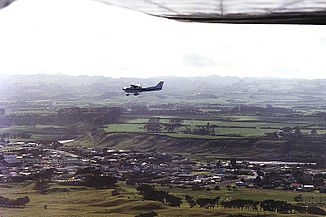
Patea River
| Patea River | ||
|
Patea and Valley of the Patea River |
||
| Data | ||
| location | Taranaki Region , North Island , New Zealand | |
| River system | Patea River | |
| source | Eastern slope of Mount Taranaki west of Stratford Mountain House. 39 ° 18 ′ 24 ″ S , 174 ° 6 ′ 35 ″ E |
|
| muzzle |
South Taranaki Bight near Patea Coordinates: 39 ° 46 ′ 25 " S , 174 ° 29 ′ 20" E 39 ° 46 ′ 25 " S , 174 ° 29 ′ 20" E |
|
| Mouth height |
0 m
|
|
| length | 105 km | |
| Left tributaries | Mangaehu Stream, Mangakotuku Stream, Mangatoromiro Stream, Hauha Stream, Ngakotana Stream, Ohio Stream | |
| Right tributaries | Ngaere Stream, Waihapa Stream, Katatuna Stream, Makjaria Stream, Maruarau Stream, Tutaeariari Stream, Otauria Stream, Okirau Stream, Urekawa Stream, Waireka Stream | |
| Reservoirs flowed through | Lake Rotorangi | |
| Small towns | Patea , Stratford | |
|
Lower course and patea |
||
The Patea River is a river in Stratford District in the region Taranaki on the North Island of New Zealand . It rises near East Egmont on the eastern slope of Mount Taranaki, west of the Stratfort Mountain House refuge .
It flows through Stratford in an easterly direction , then turns south, passes northeast of Patea and soon afterwards flows into the South Taranaki Bight of the Tasman Sea .
The river was the gateway to South Taranaki for both the Māori and early European settlers. The river is the only boat-accessible river in South Taranaki and is now also used for canoeing.
During the colonial existence of the provinces of New Zealand , the Patea River was the border between the provinces of New Ulster and New Munster from 1841 to 1853 .
The Lake Rotorangi on the middle reaches of the river is 46 km, the longest dam of New Zealand, he was by the construction of 1,979 to 1,984 by the build from Egmont Electric Power Board to generate electricity Patea Dam dammed.
On the east bank of the river on the southern outskirts of Patea, the Patea Freezing Works , a large meat processing company, was located from 1910 to 2010 .
The SH3 crosses the river in Patea. The Marton-New Plymouth Line railway follows the lower course of the river on the west bank and crosses it at Patea, then follows the east bank, passes the former site of the Patea Freezing Works and turns east.
In the river is on rainbow trout fishing, which can reach trophy size in the upper reaches.
Natural gas is extracted in the area of the upper reaches at the confluence with the Ngaere Stream.
Individual evidence
- New Zealand topographic maps NZTopo50, map sheets BK30, BJ31, BJ30, BJ29

