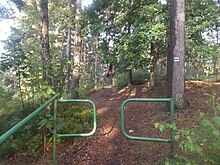
Paulsdorfer Heide
The Paulsdorfer Heide is an approximately three km² forest area in the Eastern Ore Mountains, west of the eponymous village of Paulsdorf . It is located on the territory of the city of Dippoldiswalde . In the west the forest area borders on the Höckendorfer Heide , in the south on the Schwarz-Busch. Adjacent villages are Paulshain in the west, Paulsdorf in the east, Seifen in the northeast and Seifersdorf in the north, it is between 353.5 m above sea level. NHN and 431.7 m above sea level NHN .
Responsibility lies with the Forestry Office in Bärenfels , owned by the Free State of Saxony.
history
On Matthias Oeder's maps in 1586/1607, the Paulsdorfer Heide is referred to as "Beyreuter Heide". It was already called "Pausldorfer Heide" for an arranged hunt by the Elector of Saxony in 1668. The water of the Borlasbach used to be dammed on a wall below Paulshain . There was already gold washing there in 1560. On the road between Paulsdorf and Paulshain, several unsuccessful attempts were made to mine hard coal in the 19th century. Until the complete change of administration to Bärenfels there was a branch in the former forest estate in Höckendorf am Schenkberg. From the 17th century, clay pits were used to extract clay for the production of high-quality ceramics by the pottery craftsmen based in Dippoldiswalde.
Attractions
On the high plateau of the Steinberg, which was dedicated to Erashöhe in 1899 , there was a refuge that was erected by the Kulturbund in 1979 until November 2018. Opposite is an antenna mast about 100 meters away, which was built in 1987 as a test object by the TU Dresden and has since served as a television radio mast for the surrounding villages. The climbing rocks Altar (Eras, 11.30 m high) and pulpit (8.50 m high) rise free-standing as rocks next to the Erashöhe on the radio mast. They were used for climbing as early as 1901. They are looked after by the tourist club "Eras" founded in 1911.
Below the Sandberg, accessible from the O-Weg, is the Great Quarry, which was operated at a depth of up to 25 meters until 1956. From then until 1997 it served as a shooting range for the Saxony police . Located on Schieferweg is the source of the Seifenbach, which rises from two historic wells (Knöfel-Brunnen, 1853 according to the keystone, and Helfter-Grundbrunnen) and flows into the Malter dam .
The rocks along the Steinberg and Sandberg are under special protection (biotope).
ways
The O-Weg is mentioned as a forest wing in the forest book as early as 1727 and runs from the district road 9010 near Seifersdorf to shortly before Paulshain, where it joins the L-Weg. The Kirchweg, which was also known as the S-Weg in the 18th century, begins today at the edge of the forest in Seifersdorf and leads to Paulshain. It used to be the quickest connection between the Paulshain residents and the Seifersdorf church , where they were parish. The Wildweg, which is already mentioned in the 19th century, runs from the O-Weg over the Kirchweg, today as a section on the edge of the forest in Seifersdorf over the unnamed section Wildsteig to the Seifersdorfer Bad at the Malter dam. The L-Weg has been running through the heath since the 18th century, starting in the south near the Schwarzbusch, via Paulshain and continuing into the Höckendorfer heath. The Marktsteig, which runs from Ruppendorf through the southern part of the heath (crossing the L-way) towards Dippoldiswalde, was built in the Middle Ages. The so-called Mühlweg from Paulshain to Paulsdorf ran through the last-mentioned forest section .
literature
- Between Tharandt forest, Freital and the Lockwitztal (= values of our homeland . Volume 21). 1st edition. Akademie Verlag, Berlin 1973, p. 177.
Web links
- Paulsdorfer Heide on the Seifersdorf website
- Paulsdorf and the Heide on the Dippoldiswalder website
Coordinates: 50 ° 55 ′ 15 ″ N , 13 ° 37 ′ 29 ″ E


