Peacehaven
| Peacehaven | |||
|---|---|---|---|
|
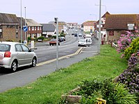
 Main street of Peacehaven |
||
| Basic data | |||
| status | Town and Civil Parish | ||
| surface | 5.19 km² | ||
| population | 14,067 (as of 2011) | ||
| Ceremony county | East Sussex | ||
| District | Lewes District | ||
| Constituency | Brighton Kemptown | ||
| Website: www.peacehaventowncouncil.gov.uk | |||
Peacehaven is a coastal town and at the same time a civil parish with almost 15,000 inhabitants in the Lewes District of East Sussex in south-east England .
geography
Peacehaven is on the coast of the English Channel , approximately 10 kilometers east of Brighton and 18 kilometers west of Eastbourne , in the South Downs . The prime meridian runs through the area of the municipality . The village itself is around 40 meters above sea level and borders in the south on the upper edge of the chalk cliffs that mark the coastline here. This and the beach in front of it fall within the area of the Brighton to Newhaven Cliffs nature reserve, which is designated as a Site of Special Scientific Interest , while smaller, undeveloped areas in the north-east of the community are part of the South Downs National Park . At the time of the 2011 census, the population was 14,067, the district area is 5.19 square kilometers. Neighboring parishes are Newhaven in the east, Piddinghoe in the north and Telscombe in the west. Peacehaven has grown together structurally with the latter.
history
Peacehaven was founded in 1914 in the area of the parish of Piddinghoe by the entrepreneur Charles Neville, who had the intention of creating a coastal garden city . Because there was temporarily an ANZAC camp at this point , the place was originally called New Anzac-on-Sea . After the Battle of Gallipoli , that name was no longer felt to be appropriate and a newspaper competition found a new name for the settlement. The Daily Express sued Neville over the competition, calling it a hoax in which "free" city plots were promised as second prizes but only actually handed out on payment of a transfer fee. Although the newspaper won the case, Peacehaven also took advantage of the free advertising.
In 1929 Peacehaven was separated from Piddinghoe and has since formed its own community.
Buildings
Two buildings and facilities in the municipality are classified as culturally and historically significant. These are a former shepherd's hut as a Listed Building in Category II and a barrow as a Scheduled Monument .
In 1936 a monument was erected directly on the edge of the cliffs, which marks the course of the meridian. It was originally intended to be dedicated to the 25th anniversary of King George V's throne . However, he died during the planning phase, so it is reminiscent of the monarch himself. After the edge of the cliffs had come threateningly closer to the monument due to progressive erosion , it was moved in the 1960s by nine and in 1981 by a further seven meters inland.
Town twinning
Peacehaven maintains twinning with Isernhagen in Lower Saxony and the French community Epinay-sous-Senart .
Web links
- Official website of the Town Council (English)
- Statistical data based on the census on the site of the 2011 Office for National Statistics (English)
- Peacehaven in the database the Ordnance Survey (English)
- Historical information on the Town Council website
Individual evidence
- ↑ Cartographic representation on the map server of the Department for Environment, Food and Rural Affairs (DEFRA), accessed on March 27, 2018
- ↑ Parishes: Piddinghoe. In: LFSalzman (ed.): A History of the County of Sussex : Volume 7, the Rape of Lewes. London 1940, p. 66. British History Online, accessed March 27, 2018. (English)
- ^ Database query Peacehaven Parish on the website of Historic England, carried out on March 27, 2018. (English)
- ↑ Information about the monument on a website on the Greenwich Meridian, accessed on March 27, 2018 (English)
Coordinates: 50 ° 48 ′ N , 0 ° 0 ′ W


