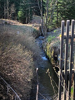
Pechöferbach
|
Pechöferbach Pechöfener Bach |
||
|
It flows into the Jugelbach |
||
| Data | ||
| location | Saxony , Germany | |
| River system | Elbe | |
| Drain over | Jugelbach → Breitenbach → Schwarzwasser → Zwickauer Mulde → Mulde → Elbe → North Sea | |
| source | northeast of the Scheffelsberg 50 ° 24 '4 " N , 12 ° 42' 35" E |
|
| muzzle | in Unterjugel in den Jugelbach Coordinates: 50 ° 25 ′ 15 " N , 12 ° 43 ′ 39" E 50 ° 25 ′ 15 " N , 12 ° 43 ′ 39" E
|
|
| length | about 2 km | |
The Pechöferbach , also Pechöfen-Bach , Pechöfener Bach or Grenzbach (Czech: Smolný potok or Hraniční potok), is a nearly 2 km long, right tributary of the Jugelbach , which runs in Johanngeorgenstadt in the Saxon Ore Mountains along the Czech border.
course
The Pechöferbach, which was named after the settlement of the same name Pechöfen ( Smolné Pece ) on the Bohemian side, rises on the ridge of the Ore Mountains, northeast of the Scheffelsberg above Oberjugel . Its eastern source stream forms the border with the Czech Republic from the source. In the upper reaches it takes on the Kleine Jugelbach from the left .
In a depression, the Pechöferbach flows northeast towards Unterjugel, where it flows into the Jugelbach in Lehmergrund not far from the former Zinnhütte , which from now on forms the border with the Czech Republic.

