List of rivers in the Ore Mountains
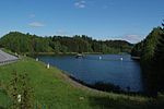
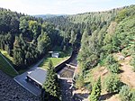
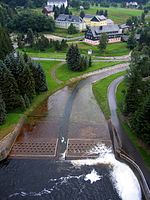
The list of rivers in the Ore Mountains is a listing of all major natural rivers that arise in the Saxon-Bohemian Ore Mountains / Krušné hory. It is based on the boundaries of the corresponding natural areas . It includes all rivers and streams with a length of more than about 5 km or a catchment area over 10 km 2 . The latter corresponds to the size from which running waters are subject to reporting according to the specifications of the European Water Framework Directive (WFD). In addition, smaller streams are listed if they are dammed into dams . By specifying hydrological indicators, information on the water network in the Ore Mountains can be derived.
Important rivers
Explanations
- Name : The official name was used. Other names were also listed when the number was wider. Here means: AN = alternative name, old name. Today the name is no longer used or only in regional usage. This also includes the German-language names for the waters in the Bohemian Ore Mountains. OL = upper course, TS = section, UL = lower course: For historical reasons, some sections have a different name that is still used today. However, a uniform water body code identifies this as a body of water. CZ = Czech name for cross-border or border waters.
- FLOZ : The river order number is a measure of the branching of a water network. The Elbe as the main river is assigned the number "1", its tributaries the "2", its tributaries the "3" etc.
- The main river is the estuary.
- Ri : Direction of the inflow into the estuary (li = left tributary, right = right tributary)
- GKZ : With the nationally assigned water body code, every body of water can be clearly identified. The hierarchical structure of the German water body index (GKZ) allows the derivation of the respective river system . The GKZ beginning with “5” mark the listed waters as belonging to the river system of the Elbe . To identify the river systems, the GKZ was separated by hyphens. This means: 532 = Eger , 537 = upper Elbe, 541 = Zwickauer Mulde , 542 = Freiberg Mulde and 566 = White Elster . The Czech waterway code has a similar structure, but it consists of four parts, the last of which designates an area. The "1" stands for the Elbe with the following areas of the water network. For the Ore Mountains in particular the number ranges 1-13 (Eger), 1-14-01 ( Bílina ), 1-15-02 (left tributaries of the Elbe), 1-15-03 (Freiberg Mulde) and 1-15-04 (Zwickauer Mulde) relevant.
- A Eo : The catchment area comprises the area in square kilometers on the earth's surface that is drained by a river. It is limited by the watershed . Each sub-catchment area in turn is included in the catchment area of the receiving river.
- Length : The length indicates the total length of the river in kilometers. Sections with different names, but with a common GKZ, are grouped together. The information comes from official information and the waterway map.
- Source , mouth : The information comes from official topographical maps and the waterway map. In the rare cases where there is published information on the amount, these have been adopted. Because of the different reference systems, no normalization to zero normal height was made; all values are therefore to be understood as approximate information.
table
The table is sortable. By clicking on a column header, the list is sorted according to this column, another click reverses the sorting. The original classification in the table is upstream, with each tributary being followed on the left from the mouth to the source.
| Name (alternative name ) |
SEAM | GKZ | Ri | Inflow to | Length [km] |
A Eo [km²] |
Source height / position |
Mouth height / location |
image |
|---|---|---|---|---|---|---|---|---|---|
|
Göltzsch (OL: White Göltzsch) |
4th | 566-2 | re | White magpie | 40.5 | 232 |
711 m |
257.3 m |

|
| Plohnbach | 5 | 566-24 | re | Göltzsch | 12.2 | 25.8 |
562 m |
369 m |

|
| Wernesbach | 5 | 566-22 | re | Göltzsch | 9.2 | 20.9 |
719 m |
423 m |

|
| Pöltzsch (OL: Eulenwasser) |
5 | 566-218 | re | Göltzsch | 6.2 | 12.7 |
668 m |
426 m |
|
| Red Göltzsch | 5 | 566-214 | re | Göltzsch | 4.8 | 9.3 |
686 m |
485.8 m |

|
|
Drive (OL: Geigenbach) |
4th | 566-18 | re | White magpie | 32.7 | 163 |
763 m |
304.2 m |
|
| Görnitzbach | 4th | 566-136 | re | White magpie | 15.2 | 45.9 |
749 m |
394.4 m |
|
| Kottengrüner Bach | 5 | 566-1366 | re | Görnitzbach | 6.6 | 9.6 |
622 m |
427 m |
|
| Würschnitzbach | 4th | 566-134 | re | White magpie | 13.2 | 30.7 |
750 m |
410 m |
|
|
Schwarzbach (OL: Floßbach, Hinterer Langebach) |
4th | 566-12 | re | White magpie | 15th | 55.5 |
737 m |
441 m |

|
| Ebersbach | 5 | 566-126 | re | Schwarzbach | 6.6 | 13.1 |
685 m |
470 m |
|
|
Zwickauer Mulde (TO: Western Mulde) |
3 | 541 | left | trough | 167 | 2,352 |
710 m |
132.4 m |

|
| Gablenzbach | 5 | 541-8932 | re | Chemnitz | 9.2 | 18.4 |
464 m |
292 m |
|
|
Würschnitz (OL: Beuthenbach) |
5 | 541-82 | left | Chemnitz | 29 | 137 |
518 m |
313.1 m |
|
|
Gablenzbach (AN: Stollberger Wasser) |
6th | 541-822 | re | Würschnitz | 11.1 | 33 |
599 m |
366.0 m |

|
| Lower Querenbach | 7th | 541-8226 | re | Gablenzbach (Würschnitz) | 3.1 | 6.5 |
530 m |
396 m |

|
|
Zwönitz (TO: Zwönitzbach) |
5 | 541-81 | re | Chemnitz | 39.2 | 144 |
697 m |
313.1 m |

|
| Stadtguttalbach (AN: Einsiedler Bach) |
6th | 541-818 | re | Zwönitz | 1.9 | 1.9 |
470 m |
343 m |

|
|
Gornsdorfer Bach (AN: Wildbach) |
6th | 541-814 | re | Zwönitz | 7.7 | 18.1 |
670 m |
419 m |
|
| Rödelbach | 4th | 541-4 | left | Zwickauer Mulde | 25th | 129 |
620 m |
280 m |

|
| Crinitzer water | 5 | 541-46 | left | Rödelbach | 15th | 60.7 |
613 m |
310 m |

|
| Hirschfelder Wasser (OL: Stangengrüner Bach) |
6th | 541-4614 | left | Crinitzer water | 7.6 | 22.3 |
519 m |
349 m |
|
| Irfersgrüner Bach | 7th | 541-46142 | left | Hirschfelder water | 4.2 | 14.4 |
440 m |
367 m |
|
| Amselbach | 4th | 541-378 | left | Zwickauer Mulde | 2.3 | 2.6 |
396 m |
291.5 m |

|
| Thierfelder Bach | 4th | 541-36 | re | Zwickauer Mulde | 5.9 | 8.8 |
466 m |
314 m |
|
|
Schlemabach (AN: Schlema, Knappschaftsbach) |
4th | 541-34 | left | Zwickauer Mulde | 10 | 28.6 |
573 m |
325 m |

|
| Alberoda Bach | 4th | 541-332 | re | Zwickauer Mulde | 5.9 | 6.0 |
536 m |
335.3 m |

|
|
Lößnitzbach (OL: Affalterbach) |
4th | 541-32 | re | Zwickauer Mulde | 10.4 | 28.4 |
582 m |
337 m |

|
| Aubach (OL: Hintere Aue) |
5 | 541-322 | left | Loessnitzbach | 5.8 | 13.9 |
577 m |
396 m |
|
|
Schwarzwasser (OL: Seifenbächel, CZ: Černá) |
4th | 541-2 1-15-04-005 |
re | Zwickauer Mulde | 49.4 | 365 | 1,117 m |
342.3 m |

|
| Great Mittweida | 5 | 541-28 | re | Black water | 21.6 | 166 | 1,165 m |
412.4 m |
|
| Oswaldbach | 6th | 541-2892 | re | Great Mittweida | 9.5 | 21st |
684 m |
419 m |

|
| Schwarzbach | 6th | 541-286 | re | Great Mittweida | 11.9 | 18.2 |
675 m |
425 m |

|
|
Pöhlwasser (AN: Kaffwasser, OL: Klingerbach) |
6th | 541-284 1-15-04-015 |
left | Great Mittweida | 20.7 | 84.6 | 1,053 m |
437 m |
|
| Friedrichsbach | 6th | 541-2848 | re | Pöhlwasser | 6.8 | 11.4 |
888 m |
466 m |
|
| Little Mittweida | 6th | 541-282 | left | Great Mittweida | 7.1 | 9.3 |
943 m |
569 m |
|
| Big local stream | 5 | 541-26 | re | Black water | 5 | 9.2 |
907 m |
577 m |

|
| Steinbach | 5 | 541-24 | left | Black water | 8th | 18th |
940 m |
600 m |

|
|
Breitenbach (CZ: Blatenský potok) |
5 | 541-22 1-15-04-010 |
left | Black water | 8.2 | 30.7 |
907 m |
682 m |

|
|
Jugelbach (TO: Lehmergrundbach) |
6th | 541-222 | left | Breitenbach | 4.7 | 9.7 |
927 m |
707 m |

|
|
Podleský potok (AN: Streitseifner Bach) |
5 | 1-15-04-006 | re | Black water | 4.5 | 8.8 |
950 m |
728 m |

|
|
Zschorlaubach (OL: Filzbach) |
4th | 541-18 | left | Zwickauer Mulde | 12 | 22.3 |
597 m |
390 m |

|
| Dorfbach ( Bockau ) | 4th | 541-176 | re | Zwickauer Mulde | 6.4 | 12.8 |
784 m |
425 m |

|
| Sosabach | 4th | 541-174 | re | Zwickauer Mulde | 7.1 | 15.1 |
822 m |
456 m |
|
| Great Bockau | 4th | 541-16 | re | Zwickauer Mulde | 14th | 39.3 |
922 m |
466.0 m |

|
| Little Bockau | 5 | 541-164 | re | Great Bockau | 6.3 | 9.8 |
886 m |
513 m |

|
| Weissbach | 4th | 541-15736 | left | Zwickauer Mulde | 6.6 | 15.3 |
657 m |
540 m |
|
| Rähmerbach | 4th | 541-15734 | re | Zwickauer Mulde | 7.3 | 12.5 |
872 m |
540 m |
|
| Wilzsch | 4th | 541-14 | re | Zwickauer Mulde | 13.3 | 25th |
950 m |
591.5 m |

|
| Great pyra | 4th | 541-12 1-15-04-001 |
re | Zwickauer Mulde | 11.3 | 27 |
930 m |
620 m |

|
| Little Pyra | 4th | 541-116 | re | Zwickauer Mulde | 6.3 | 14.8 |
833 m |
624.6 m |

|
| Red hollow | 4th | 541-111 | left | Zwickauer Mulde | 4.5 | 8.3 |
768 m |
710 m |
|
| White hollow | 4th | 541-1112 | re | Zwickauer Mulde | 4.3 | 7.5 |
773 m |
710 m |
|
|
Freiberger Mulde (AN: Eastern Mulde, CZ / OL: Moldavský potok) |
3 | 542 1-15-03-001 |
re | trough | 124 | 2,981 |
850 m |
132.4 m |

|
| Zschopau | 4th | 542-6 | left | Freiberg Mulde | 130 | 1,847 | 1,150 m |
155.4 m |

|
| Euba Bach | 5 | 542-692 | left | Zschopau | 8.6 | 15.7 |
446 m |
260 m |

|
|
Flöha (CZ: Flájsky potok) |
5 | 542-68 1-15-03-023 |
re | Zschopau | 78 | 799.4 |
845 m |
265.4 m |

|
| Hetzbach | 6th | 542-6894 | re | Flea | 10.1 | 23.9 |
469 m |
285 m |

|
|
Große Lößnitz (OL: Großwaltersdorfer Bach) |
6th | 542-688 | re | Flea | 15th | 65.3 |
518 m |
290 m |

|
| Gahlenz Bach | 7th | 542-6886 | re | Great Loessnitz | 6.0 | 17.1 |
479 m |
357.2 m |
|
| Weissbach | 7th | 542-6888 | re | Great Loessnitz | 4.2 | 10.1 |
521 m |
441.8 m |
|
| Roethenbach | 6th | 542-68752 | re | Flea | 5.8 | 12.0 |
523 m |
356.9 m |
|
|
Lautenbach (OL: Pfützenbach) |
6th | 542-6874 | left | Flea | 13.5 | 29.9 |
629 m |
363 m |

|
| Saidenbach | 6th | 542-6872 | re | Flea | 15.8 | 61.3 |
650 m |
375 m |
|
| Haselbach | 7th | 542-68726 | left | Saidenbach | 12.3 | 28.9 |
683 m |
438 m |

|
|
Black Pockau (CZ: Černá) |
6th | 542-686 | left | Flea | 33 | 120.8 |
900 m |
400 m |

|
| Knesenbach | 7th | 542-6866 | re | Black Pockau | 6.2 | 9.8 |
662 m |
453 m |
|
| Red Pockau | 7th | 542-6864 | left | Black Pockau | 10.2 | 46.6 |
771 m |
490 m |

|
| Schlettenbach | 8th | 542-68642 | left | Red Pockau | 6.5 | 21.9 |
645 m |
503 m |
|
|
Bielabach (AN: Biela) |
6th | 542-6854 | re | Flea | 14.3 | 33.8 |
660 m |
430 m |

|
| Rungstockbach | 6th | 542-6852 | re | Flea | 8.5 | 15.7 |
799 m |
448 m |

|
|
Natzschung (CZ: Načetínský potok) |
6th | 542-684 1-15-03-043 |
left | Flea | 16.5 | 80.3 |
820 m |
468 m |

|
| Bílý potok | 7th | 1-15-03-044 | re | Netting | 5.1 | 13.8 |
859 m |
669 m |
|
| Telčský potok (AN: Töltzschbach) |
7th | 1-15-03-046 | re | Netting | 9.6 | 17.1 |
865 m |
558 m |

|
|
Schweinitz (CZ: Svídnice) |
6th | 542-682 1-15-03-034 |
left | Flea | 17.6 | 63.3 |
807 m |
475 m |
|
| Seiffen Bach | 5 | 542-6822 | re | Schweinitz | 7.2 | 11.2 |
736 m |
510 m |
|
| Mortelbach | 6th | 542-6818 | re | Flea | 5.4 | 13.3 |
681 m |
500 m |
|
| Cämmerswalder Dorfbach | 6th | 542-6816 | re | Flea | 4.9 | 10.1 |
673 m |
552 m |
|
| Rauschenbach (CZ: Bystrý potok) |
6th | 542-6812 1-15-03-030 |
re | Flea | 5.2 | 9.5 |
755 m |
602 m |
|
| Schwarzbach | 5 | 542-678 | left | Zschopau | 8.4 | 15.6 |
495 m |
487 m |
|
| Dittmannsdorfer Bach | 5 | 542-676 | left | Zschopau | 7.0 | 17.7 |
453 m |
292 m |
|
| Krumhermersdorfer Bach | 5 | 542-672 | re | Zschopau | 4.8 | 9.2 |
528 m |
312 m |
|
| Wilisch | 5 | 542-66 | left | Zschopau | 17.9 | 65.5 |
635 m |
332 m |

|
| Jahnsbach | 5 | 542-662 | left | Wilisch | 5.2 | 13.5 |
634 m |
463.8 m |
|
| Drebacher Bach | 5 | 542-656 | left | Zschopau | 7.9 | 16.7 |
517 m |
344 m |
|
|
Preßnitz (CZ: Přísečnice) |
5 | 542-64 1-15-03-011 |
re | Zschopau | 37 | 209 |
898 m |
395.5 m |

|
| Sandbach | 6th | 542-6492 | left | Pressnitz | 11.5 | 12.0 |
798 m |
419 m |
|
| Rauschenbach | 6th | 542-648 | left | Pressnitz | 7.8 | 13.7 |
768 m |
472 m |

|
| Haselbach | 6th | 542-646 | re | Pressnitz | 7.4 | 12.0 |
794 m |
508 m |
|
| Steinbach | 6th | 542-6454 | re | Pressnitz | 4.6 | 11.2 |
863 m |
538 m |
|
|
Schwarzwasser (CZ: Černá Voda, AN: Jöhstädter Schwarzwasser) |
6th | 542-644 1-15-03-019 |
left | Pressnitz | 22nd | 46.6 |
960 m |
595 m |
|
|
Pöhlbach (CZ: Polava) |
5 | 542-634 1-15-03-004 |
re | Zschopau | 32.5 | 86.7 | 1,100 m |
415 m |

|
| Sehma | 5 | 542-62 | re | Zschopau | 23.5 | 61.1 |
720 m |
464.5 m |

|
| Lampertsbach | 5 | 542-624 | re | Sehma | 5.6 | 11.2 |
805 m |
623 m |

|
|
Greifenbach (OL: Red Water) |
5 | 542-616 | left | Zschopau | 12.3 | 18.7 |
733 m |
488 m |
|
|
Geyerbach (OL: Einsbächel) |
5 | 542-614 | left | Zschopau | 7.2 | 14.4 |
713 m |
497 m |

|
| Red puddle | 5 | 542-612 | left | Zschopau | 6.1 | 24.0 |
616 m |
550.8 m |
|
|
Striegis Great Striegis |
4th | 542-4 | left | Freiberg Mulde | 48 | 283 |
546 m |
181 m |

|
| Little Striegis | 5 | 542-46 | left | Striegis | 22nd | 69 |
444 m |
240 m |
|
| Kemnitzbach | 5 | 542-42 | left | Striegis | 6.6 | 17.9 |
431 m |
325 m |
|
| Schirmbach | 5 | 542-418 | re | Striegis | 5.5 | 9.5 |
442 m |
338 m |

|
| Oberreichenbacher Bach | 5 | 542-414 | left | Striegis | 5.8 | 12.5 |
494 m |
357 m |
|
| Bobritzsch | 4th | 542-2 | re | Freiberg Mulde | 45 | 181.9 |
674 m |
235 m |
|
| Rodelandbach | 5 | 542-26 | re | Bobritzsch | 10 | 19.8 |
386 m |
285 m |
|
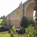
| Colmnitzbach | 5 | 542-24 | re | Bobritzsch | 14th | 26.4 |
503 m |
349 m |
|
| Sohrbach | 5 | 542-22 | re | Bobritzsch | 6.4 | 12.2 |
466 m |
392 m |
|
| Kleinwaltersdorfer Bach | 4th | 542-192 | left | Freiberg Mulde | 8.2 | 19.0 |
430 m |
293 m |
|
|
Münzbach (TO: Loßnitzbach) |
4th | 542-16 | left | Freiberg Mulde | 18.5 | 31.7 |
527 m |
297 m |

|
| Gimmlitz | 4th | 542-14 | re | Freiberg Mulde | 25th | 54.3 |
780 m |
386.8 m |

|
| Großhartmannsdorfer Bach | 4th | 542-134 | left | Freiberg Mulde | 11.5 | 25.6 |
550 m |
394 m |
|
| Zethaubach | 4th | 542-132 | left | Freiberg Mulde | 8.9 | 23.7 |
656 m |
417 m |
|
| Helbigsdorfer Bach | 5 | 542-1324 | left | Zethaubach | 6.7 | 11.1 |
530 m |
424 m |
|
| Chemnitzbach | 4th | 542-12 | left | Freiberg Mulde | 16 | 48.0 |
656 m |
421 m |

|
| Voigtsdorfer Bach | 5 | 542-122 | left | Chemnitzbach | 5.2 | 14.7 |
630 m |
521 m |
|
| Nassauer Dorfbach | 4th | 542-116 | re | Freiberg Mulde | 7.1 | 9.0 |
728 m |
491 m |
|
| Instinctively | 2 | 537-32 | left | Elbe | 37 | 179 |
428 m |
106 m |

|
|
Wild Weißeritz (CZ: Divoká Bystřice) |
3 | 537-21 1-15-02-033 |
left | Weißeritz | 52.5 | 162.7 |
850 m |
182.8 m |

|
| Schloitzbach | 4th | 537-218 | left | Wild Weisseritz | 5.2 | 18.6 |
310 m |
212 m |

|
| Höckenbach | 4th | 537-2172 | re | Wild Weisseritz | 8.7 | 16.7 |
468 m |
280 m |

|
| Weissbach | 4th | 537-212 | left | Wild Weisseritz | 4.6 | 7.4 |
750 m |
579.2 m |

|
| Rote Weißeritz | 3 | 537-22 | re | Weißeritz | 36.5 | 161.2 |
787 m |
182.6 m |

|
| Oelsabach | 4th | 537-228 | re | Rote Weißeritz | 15th | 28 |
434 m |
249 m |

|
| Borlasbach | 4th | 537-2274 | left | Rote Weißeritz | 5.8 | 9.3 |
402.5 m |
259 m |

|
| Reichstädter Bach | 4th | 537-22532 | left | Rote Weißeritz | 8.5 | 15.5 |
522 m |
333 m |
|
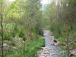
| Pöbelbach | 4th | 537-222 | left | Rote Weißeritz | 12 | 18.1 |
807 m |
434 m |
|
|
Lockwitzbach (TO: Grimm's Water) |
2 | 537-192 | left | Elbe | 29.5 | 84 |
570 m |
117 m |

|
|
Müglitz (CZ / OL: Mohelnice, OL: White Müglitz) |
2 | 537-18 | left | Elbe | 49 | 209 |
780 m |
113 m |

|
|
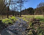
Trebnitz (AN: Trebnitzbach) |
3 | 537-188 | re | Müglitz | 11.9 | 20.3 |
579 m |
263 m |
|
| Brießnitzbach (AN: Prießnitz) |
3 | 537-186 | left | Müglitz | 7.1 | 15.3 |
617 m |
320 m |

|
| Great Biela | 3 | 537-184 | left | Müglitz | 7.2 | 17.0 |
758 m |
406.0 m |
|
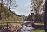
| Red water (OL: Erdbach, Hüttenbach, AN: Rote Müglitz) |
3 | 537-182 | left | Müglitz | 8.7 | 28.4 |
783 m |
469.1 m |
|
|
Gottleuba (CZ / OL: Rybný potok) |
2 | 537-14 1-15-02-020 |
left | Elbe | 33.9 | 252 |
642 m |
113 m |

|
| Seidewitz | 3 | 537-148 | left | Gottleuba | 25th | 99.4 |
596 m |
118 m |

|
| stretcher | 4th | 537-1488 | re | Seidewitz | 15th | 42.3 |
504 m |
150 m |
|
|
Bahra (CZ / OL: Petrovicky potok, OL: Buschbach) |
3 | 537-146 1-15-02-026 |
re | Gottleuba | 18th | 73 |
680 m |
243 m |

|
|
Mordgrundbach (CZ / OL: Slatina) |
4th | 537-1464 1-15-02-027 |
left | Bahra | 10 | 18.2 |
716 m |
390 m |

|
| Loschebach (CZ / OL: Olšový potok) |
4th | 537-14614 1-15-02-024 |
re | Bahra | 9.2 | 17.4 |
638 m |
413.7 m |

|
|
Bílina (TO: Biela) |
2 | 1-14-01-001 | left | Elbe | 82 | 1,082 |
823 m |
132 m |

|
| Ždírnický potok (AN: Sernitzbach) |
3 | 1-14-01-093 | left | Bílina | 14.5 | 119.8 |
756 m |
142 m |

|
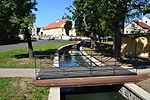
| Modlanský potok | 5 | 1-14-01-090 | re | Zalužanský potok | 12.4 | 34.2 |
789 m |
194 m |
|
| Telnický potok (AN: Tellnitz) |
3 | 1-14-01-094 | left | Ždírnický potok | 7.6 | 16.5 |
743 m |
247 m |
|
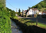
| Bystřice (AN: Seegrundbach, Flößbach) |
3 | 1-14-01-073 | left | Bílina | 19.9 | 69.6 |
870 m |
170 m |
|
| Bouřlivec (AN: Riesenbach) |
3 | 1-14-01-056 | left | Bílina | 18.6 | 115.4 |
756 m |
188 m |

|
| Křižanovský potok (AN: Krinsdorfer Bach) |
4th | 1-14-01-057 | re | Bouřlivec | 5.3 | 10.0 |
832 m |
308 m |
|
| Bílý potok (AN: Weißbach, Goldfluss) |
3 | 1-14-01-020 | left | Bílina | 15.8 | 39.8 |
860 m |
230 m |
|
| Loupnice (TO: Frauenbach) |
3 | 1-14-01-017 | left | Bílina | 13.1 | 59.7 |
790 m |
230 m |

|
| Jiřetínský potok | 4th | 1-14-01-016 | re | Loupnice | 6.9 | 25.7 |
743 m |
233 m |
|
| Šramnický potok | 5 | 1-14-01-008 | re | Jiřetínský potok | 8.6 | 16.8 |
881 m |
233 m |

|
| Lužec (AN: Aubach, CZ / AN: Nivský potok) |
3 | 1-14-01-006 | left | Bílina | 13.1 | 15.6 |
872 m |
287 m |
|
|
Chomutovka (AN: Assigbach) |
3 | 1-13-03-106 | left | Eger | 49 | 159 |
863 m |
181 m |

|
|
Hačka (TO: Hatschka) |
4th | 1-13-03-115 | left | Chomutovka | 14.6 | 29.1 |
615 m |
195.5 m |

|
| Křímovský potok (AN: Krimaer Bach) |
4th | 1-13-03-111 | re | Chomutovka | 6.5 | 11.7 |
831 m |
486 m |

|
| Kamenička (TO: Neuhauser Flößbach) |
4th | 1-13-03-107 | left | Chomutovka | 6.0 | 18.5 |
826 m |
487 m |

|
|
Hutná (TO: Saubach) |
3 | 1-13-03-037 | left | Eger | 32 | 60 |
630 m |
195 m |

|
|
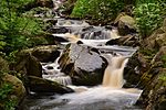
Prunéřovský potok (AN: Brunnersdorfer Bach) |
3 | 1-13-02-109 | left | Eger | 24.7 | 54.7 |
897 m |
285 m |
|
| Podmileský potok | 3 | 1-13-02-099 | left | Eger | 8.8 | 20.5 |
828 m |
288 m |

|
| Široký potok | 3 | 1-13-02-097 | left | Eger | 6.8 | 10.4 |
820 m |
289 m |
|
| Hučivý potok (AN: Weigensdorfer Bach) |
3 | 1-13-02-095 | left | Eger | 7.4 | 19.5 |
906 m |
303 m |

|
| Bočský potok | 3 | 1-13-02-087 | left | Eger | 8.6 | 14.6 | 1,033 m |
310 m |
|
| Hornohradský potok | 3 | 1-13-02-079 | left | Eger | 8.3 | 13.2 | 1,050 m |
324 m |

|
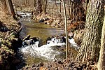
| Plavenský potok | 3 | 1-13-02-077 | left | Eger | 10.4 | 15.0 | 1,100 m |
325 m |
|
|
Bystřice (TO: Wistritz) |
3 | 1-13-02-057 | left | Eger | 29.6 | 164.5 | 1,029 m |
331 m |

|
| Vitický potok (AN: Kammersgrüner Bach) |
3 | 1-13-02-035 | left | Eger | 17.1 | 49.0 |
927 m |
366 m |
|
| Borecký potok | 4th | 1-13-02-074 | left | Bystřice | 6.0 | 13.8 |
705 m |
369 m |
|
|
Jáchymovský potok (AN: Joachimsthaler Bach, Weseritz) |
4th | 1-13-02-066 | left | Bystřice | 11 | 32.4 |
962 m |
401 m |

|
| Veseřice (AN: Weseritz?) |
5 | 1-13-02-067 | left | Jáchymovský potok | 5.0 | 12.3 | 1,021 m |
598 m |
|
| Jesenice | 4th | 1-13-02-062 | re | Bystřice | 7.2 | 10.1 |
880 m |
425 m |
|
| Eliášův potok (AN: Eliasbach) |
4th | 1-13-02-060 | left | Bystřice | 10.2 | 20th | 1,015 m |
505 m |

|
| Bílá Bystřice (TO: White Wistritz) |
4th | 1-13-02-058 | re | Bystřice | 8.8 | 18.8 | 1,024 m |
701 m |

|
|
Rolava (TO: Rohlau) |
3 | 1-13-01-165 | left | Eger | 36.7 | 137 |
922 m |
375 m |

|
| Limnice (TO: Limnitzbach) |
4th | 1-13-01-164 | left | Rolava | 6.2 | 12.3 |
933 m |
529 m |

|
|
Nejdecký potok (AN: Rodisbach, CZ / AN: Rodišovka) |
4th | 1-13-01-162 | re | Rolava | 5.6 | 16.5 |
650 m |
550 m |
|
| Černá voda (CZ / AN: Slatinny potok) |
4th | 1-13-01-156 | left | Rolava | 9.6 | 17.8 |
920 m |
745 m |

|
|
Zwota (CZ: Svatava) |
3 | 532-34 1-13-01-094 |
left | Eger | 41 | 295 |
715 m |
388.1 m |

|
| Novohorský potok | 4th | 1-13-01-116 | left | Zwota | 5.9 | 11.2 |
706 m |
451 m |
|
|
Rotava (AN: Rothau, Rothaubach) |
4th | 1-13-01-106 | left | Zwota | 15.6 | 74.2 |
950 m |
475 m |

|
|
Skřiváň (AN: Zellersbach) |
5 | 1-13-01-109 | left | Rotava | 11.3 | 28.5 |
918 m |
535 m |

|
| Kamenný potok (AN: Steinbach) |
4th | 1-13-01-100 | re | Zwota | 5.4 | 10.0 |
701 m |
509 m |

|
|
Stříbrný potok (AN: Silberbach) |
4th | 1-13-01-098 | left | Zwota | 12.3 | 29.2 |
940 m |
510 m |

|
| Brunndobra | 4th | 532-342 | left | Zwota | 7.2 | 23.7 |
790 m |
539 m |
|
| Stone Dobra | 5 | 532-3428 | left | Brunndobra | 4.6 | 8.0 |
854 m |
564 m |

|
|
Libocký potok (AN: Leibitschbach) |
3 | 1-13-01-074 | left | Eger | 31.7 | 86.6 |
763 m |
415 m |

|
| Studenecký potok | 4th | 1-13-01-079 | left | Libocký potok | 5.6 | 9.1 |
678 m |
510 m |

|
|
Zadní Liboc (AN / OL: Mühlbach, Rebbach) |
4th | 1-13-01-077 | re | Libocký potok | 11.1 | 17.9 |
766 m |
537 m |

|
Border waters
The course of the state border between Germany and the Czech Republic is mainly determined by rivers and streams; 127.5 km of the approximately 210 km long state border through the Ore Mountains run in the middle of flowing waters. There is also a nearly 20 km long section between Jugel and Klingenthal and an approx. 7 km long section near Markneukirchen and Kraslice , which almost exactly follow the Eger-Zwickau Mulde watershed or, with some deviations, the Eger- Weisse Elster watershed. The reason for this is the Treaty of Eger , with which the border between the Electorate of Saxony and the Kingdom of Bohemia was established as early as 1459 . It is one of the oldest unchanged borders in Europe. Only a small piece between Rittersgrün and Jugel, which can be recognized on the map by straight lines and jumping angles, was mutually changed between 1546 and 1556 (→ History of the Schwarzenberg District Office ). But also this change of border - here the border was also on the watershed - was determined by the waters.
| Name (german) | Name (czech) | River system | length | Border section | Remarks |
|---|---|---|---|---|---|
| Loschebach | Olšový potok | Gottleuba | 2.10 | VIII: 24-26 | |
| Bahra | Petrovický potok | Gottleuba | 0.40 | VIII: 26-26 / 8 | |
| Grenzbach | Pastvinný potok (AN: Hraniční potok) |
Gottleuba | 0.50 | VIII: 26 / 8-26 / 18 | Hraniční potok = border stream |
| Grenzbach | Pastvinný potok (AN: Hraniční potok) |
Gottleuba | 0.20 | IX: 2 / 1-2 / 9 | |
| Mordgrundbach | Slatina | Gottleuba | 0.40 | IX: 6-6 / 15 | |
| Grenzbach | Hraniční potok | Gottleuba | 0.90 | IX: 6 / 15-6 / 55 | |
| Gottleuba | Rybný potok | Gottleuba | 1.40 | IX: 9-10 | |
| Schönwalder Bach | Hraniční potok | Gottleuba | 3.30 | IX: 10-13 | |
| nameless brook | Malý Větrovský potok | Gottleuba | 0.20 | IX: 14-14 / 6 | |
| Schwarzbach | Černý potok | Müglitz | 2.40 | IX: 15-17 | |
| White Müglitz | Mohelnice | Müglitz | 5.10 | X: 3-8 / 11 | |
|
Aschergraben (Grenzgraben) |
Ašergraben (AN: Hraniční potok) |
Müglitz | 0.50 | X: 11 / 26-12 | 1452-1458 landscaped Kunstgraben for Altenberger mountain area |
| Great Warmbach | Rašelinový potok | Weißeritz | 2.00 | X: 17-18 | |
| Wild Weisseritz | Divoká Bystřice | Weißeritz | 1.00 | X: 18-19 | |
| Holperbach | Hraniční potok | Weißeritz | 1.80 | X: 19-20 / 25 | |
| Hirschbach | Jelení potok | Freiberg Mulde | 4.50 | XI: 2 / 4-6 / 8 | |
| Hirschbach | Jelení potok | Freiberg Mulde | 1.00 | XI: 6 / 11-7 | |
| Freiberg Mulde | Moldavský potok | Freiberg Mulde | 0.80 | XI: 7-8 | |
| Grenzbach | Pastvina (TO: Hraniční potok) |
Freiberg Mulde | 0.20 | XI: 8-8 / 6 | |
| Rauschenbach | Bystrý potok | Freiberg Mulde | 1.80 | XI: 11 / 5-12 / 22 | |
| Rauschenbach | Bystrý potok | Freiberg Mulde | 3.30 | XI: 12 / 26-15 / 28 | |
| Flea | Flájský potok | Freiberg Mulde | 1.50 | XII: 1-2 | |
| Wernsbach | Pstružný potok | Freiberg Mulde | 3.40 | XII: 2-4 | |
| Rainbach | Pestrý potok | Freiberg Mulde | 0.50 | XII: 4-4 / 10 | |
| Lost Brunnenbach | Ztracený potok | Freiberg Mulde | 0.30 | XII: 7 / 15-8 | |
| Grenzbach | Stříbrný potok | Freiberg Mulde | 0.20 | XII: 8 / 14-8 / 19 | |
| Schweinitz | Svídnice | Freiberg Mulde | 18.70 | XII, XIII: 10-7 | |
| Flea | Flájský potok | Freiberg Mulde | 2.00 | XIII: 7-8 | |
| Netting | Načetínský potok | Freiberg Mulde | 15.30 | XIII, XIV: 8 / 2-4 | |
| nameless brook | Mlýnský potok | Freiberg Mulde | 0.40 | XIV: 6 / 11-7 | |
| Reinungsbach | Lesní potok | Freiberg Mulde | 0.90 | XIV: 7-8 | |
| Black Pockau | Černá | Freiberg Mulde | 15.70 | XIV, XV: 8-1 / 1 | |
| Beilbach | Kamenička | Freiberg Mulde | 2.80 | XV: 2-3 | |
| Pressnitz | Přísečnice | Freiberg Mulde | 1.60 | XV: 3-4 | |
| Pöhlbach | Polava | Freiberg Mulde | 18.40 | XV, XVI: 13-13 | |
| Goldbach | Zlatý potok | Zwickauer Mulde | 0.01 | XVII: 10-10 / 1 | since border change in 1546/56 |
| Pöhlwasser | Polavský potok | Zwickauer Mulde | 0.70 | XVII: 10-10 / 10 | since border change in 1546/56 |
| Mückenbach | Komáří potok | Zwickauer Mulde | 3.10 | XVII: 10 / 10-15 | since border change in 1546/56 |
| Mückenbach | Komáří potok | Zwickauer Mulde | 0.40 | XVII: 15 / 5-15 / 9 | since border change in 1546/56 |
| Breitenbach | Blatenský potok | Zwickauer Mulde | 0.70 | XVIII: 2 / 1-3 | since border change in 1546/56 |
| Jugelbach | Široký potok (AN: Hraniční potok) |
Zwickauer Mulde | 0.30 | XVIII: 3-3 / 3 | since border change in 1546/56 |
| Pechöfener Bach | Smolný potok | Zwickauer Mulde | 3.00 | XVIII: 3 / 3-3 / 40 | since border change in 1546/56 |
| Quittenbach | Hraničná | Zwota | 2.10 | XIX: 11 / 11-12 / 1 | |
| Zwota | Svatava | Zwota | 1.50 | XIX: 13-13 / 15 | |
| Kegelbach | Kuželka | White magpie | 0.20 | XX: 6 / 5-6 / 9 |
Individual evidence
- ↑ Natural space map service of the Landschaftsforschungszentrum eV Dresden ( information )
- ^ Saxon State Ministry for the Environment and Agriculture (Ed.): European Water Framework Directive. New impulses for Saxony. Compact report on the inventory according to WFD in the Free State of Saxony . Central brochure dispatch of the Saxon State Government, Dresden 2005, p. 8 .
- ↑ a b c Map overview of the Saxon water network. Saxon State Office for Environment, Agriculture and Geology, accessed on July 13, 2014 .
- ↑ Map overview of the above-ground catchment areas. Saxon State Office for Environment, Agriculture and Geology, accessed on July 13, 2014 .
- ↑ Hydrologický seznam podrobného členění povodí vodních toků ČR. (PDF; 623 kB) Accessed November 9, 2014 (Czech).
- ↑ Hydroekologický informační systém VÚV TGM. Retrieved November 9, 2014 (Czech, database; accessed via Google search).
- ↑ Topographic map 1: 25,000
- ↑ Saxony Atlas of the Free State of Saxony ( notes )
- ↑ Turistická mapa , mapy.cz, accessed on October 15, 2014
- ↑ Richard Schmidt: The border between the color line and the solar vortex - a witness of significant Upper Ore Mountains local history. In: Erzgebirgs-Zeitung , 63rd year, 1942, pp. 85–86. ( Digitized version )
Web links
- Michael Bergemann: Complete list of flowing waters in the Elbe catchment area. (PDF; 791 kB) Working group for keeping the Elbe clean, July 1, 2015, accessed on October 9, 2015 .
