Gimmlitz
| Gimmlitz | ||
|
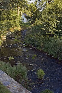
The Gimmlitz in Lichtenberg |
||
| Data | ||
| Water code | DE : 54214 | |
| location | Saxony , Germany | |
| River system | Elbe | |
| Drain over | Freiberger Mulde → Mulde → Elbe → North Sea | |
| source | near Hermsdorf / Erzgeb. 50 ° 44 ′ 32 " N , 13 ° 37 ′ 55" E |
|
| Source height | approx. 775 m above sea level NHN | |
| muzzle | in Lichtenberg in the Freiberger Mulde Coordinates: 50 ° 50 '52 " N , 13 ° 24' 10" E 50 ° 50 '52 " N , 13 ° 24' 10" E |
|
| Mouth height | 387 m above sea level NHN | |
| Height difference | approx. 388 m | |
| Bottom slope | approx. 16 ‰ | |
| length | 25 km | |
| Discharge at gauge Lichtenberg 2 A Eo : 38.91 km² Location: 6.2 km above the mouth |
NNQ MQ 1975/2010 Mq 1975/2010 MHQ 1975/2010 HHQ (August 13, 2002) |
0 l / s 438 l / s 11.3 l / (s km²) 8.23 m³ / s 48 m³ / s |
| Reservoirs flowed through | Lichtenberg dam | |
The Gimmlitz is an approximately 25 km long, right or eastern tributary of the Freiberger Mulde in Saxony , Germany .
course
It rises on the edge of the pottery forest not far from the 805 m high Schickelshöhe between Hermsdorf / Erzgeb. and Holzhau on the district border and border of the Erzgebirge / Vogtland Nature Park . Past the Weicheltmühle and other watermills , the river meanders through the Gimmlitztal , flows around the Lichtenberg castle hill , feeds the Lichtenberg dam and flows into the Freiberg Mulde in Lichtenberg not far from the former Lichtenberg moated castle .
Flood
The neighboring towns of the Gimmlitz were affected by the flood of the century in 2002 . Since it was feared that the Lichtenberg dam could not withstand the pressure of the water, parts of the Lichtenberg area were evacuated for a short time.
literature
- Gerhard Platz: The Gimmlitz. A child of the woods and meadows of our Ore Mountains . in: Communications of the Landesverein Sächsischer Heimatschutz Volume XXVI, Issue 1–4 / 1937, Dresden 1937, pp. 29–42
Web links
Individual evidence
- ↑ Hydrological Handbook. (PDF; 637 kB) Part 3 - Main aquatic values. Free State of Saxony - State Office for Environment and Geology, p. 86 , accessed on December 25, 2017 .
- ↑ Astrid Ring: Brand-Erbisdorf: The dam no longer holds water masses. In: Free Press . Retrieved August 25, 2013 .
- ↑ Special missions in the past few years: flood in August 2002. In: feuerwehr-halsbruecke.de. Halsbrücke Volunteer Fire Brigade, accessed on August 25, 2013 .
