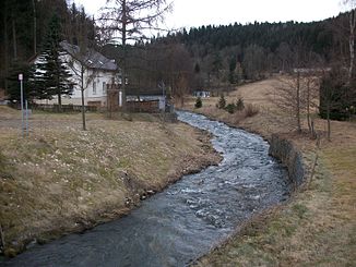
Bielabach
|
Bielabach Biela |
||
|
Bielabach in Hallbach |
||
| Data | ||
| Water code | DE : 5426854 | |
| location | Germany, Saxony | |
| River system | Elbe | |
| Drain over | Flöha → Zschopau → Freiberger Mulde → Mulde → Elbe → North Sea | |
| source | at the Schönhaide forest house between Pilsdorf and Sayda 50 ° 43 ′ 30 ″ N , 13 ° 24 ′ 13 ″ E |
|
| Source height | about 660 m above sea level NHN | |
| muzzle | near Blumenau (Olbernhau) in the Flöha coordinates: 50 ° 40 ′ 22 ″ N , 13 ° 17 ′ 48 ″ E 50 ° 40 ′ 22 ″ N , 13 ° 17 ′ 48 ″ E |
|
| Mouth height | about 430 m above sea level NHN | |
| Height difference | about 230 m | |
| Bottom slope | about 16 ‰ | |
| length | 14.3 km | |
| Catchment area | 33.8 km² | |
| Drain |
MQ |
430 l / s |
| Reservoirs flowed through | Dittmannsdorfer pond | |
| Small towns | Olbernhau | |
The Bielabach (also known as Biela for short ) is an approximately 14 km long right tributary of the Flöha near Olbernhau in the Saxon Ore Mountains .
course

The brook is formed from three wet spring troughs between Pilsdorf and Sayda . The middle one at Forsthaus Schönhaide is seen as the main source. Via Ullersdorf - this section is also known as Ullersdorfer Bach - the brook flows southwest to Dittmannsdorf . There it is dammed by the Dittmannsdorfer pond . The 11 hectare artificial pond was created between 1826 and 1828 to meet the needs of impact water in the mountain district of Brand . For this purpose, there is the possibility below the dam wall to feed the water into the artificial ditch system of the Freiberg Revierwasserlaufanstalt (upper water supply).
The brook then flows in a wide valley to Schönfeld and Pfaffroda , which extends up the slope in a side valley. With the Schönfelder pond and the Schlossteich there are two smaller standing waters. Below Pfaffroda, the brook has cut a notched valley up to 100 m deep . What is particularly striking is the balance between erosion and sedimentation , which leads to a meandering course of the stream.
At Hallbach he takes the Hallbacher Dorfbach from the right . Here the brook takes a remarkable course: like the Bärenbach and other brooks on the eastern slope of the Flöhatal, shortly before the Flöha it makes a clear bend to the south, i.e. against the slope of the Erzgebirge Pultscholle . The cause could be tectonic or related to the Rotliegend sediments that occur there .
Shortly before the mouth of the river, the now wide floodplain divides the Olbernhau districts of Kleinneuschönberg (west) and Niederneuschönberg (east). Here the water can get into the Flöha in three ways. A flood tee makes it possible to drain the water into the Flöha over a short distance. The natural, now straightened course leads parallel to the Flöha in the wide Olbernau valley basin for about 1.5 km to Blumenau . To the north a drainage ditch was dug , which was part of the drainage system for the peat cuttings near Reukersdorf and which continues about 1.5 km. These up to 4 m thick peat stores were dismantled until 1979.
Tributaries
- Sattelbach (right)
- Geiselbach (left)
- Hallbacher Dorfbach (right)
Surname
The name, which is common in the Saxon and Bohemian Ore Mountains, is derived from the Upper Sorbian "bely, bela" = white, which indicates the purity of the water.
particularities
On the lower section between Hallbach and Kleinneuschönberg there were several oil , grinding and board mills .
Large parts of the Bielabach are under protection. The dammed Dittmannsdorfer pond is part of the FFH area Freiberg Bergwerksteiche . The partially deeply cut section from Pfaffroda is part of the FFH area Flöhatal . An approximately 1.6 km long and approximately 15 hectare section between Pfaffroda and Niederlochmühle is also designated as a nature reserve Bielatal (c 39).
Historically, small stocks of freshwater pearl mussels have been documented.
See also
literature
- Bielatal. In: To Olbernhau and Seiffen (= values of our homeland . Volume 43). 1st edition. Akademie Verlag, Berlin 1985, p. 38f.
- Pfaffroda . In: August Schumann : Complete State, Post and Newspaper Lexicon of Saxony. 8th volume. Schumann, Zwickau 1821, p. 224 f.
Web links
- Bielatal (near Olbernhau) , nature guide East Ore Mountains
Individual evidence
- ↑ a b Saxony Atlas
- ↑ a b c Map of the Saxony water balance portal
- ^ Alfred Rathsburg: Geomorphology of the Flöha area. In: Research on German regional and folklore. Volume 15, 1904, p. 507 ( digitized version )
- ↑ Paul Knauth: The river names of the Erzgebirge . Vogts, Freiberg 1935, p. 22 .
- ↑ Dittmannsdorfer Teich as part of the FFH area Freiberger Bergwerksteiche on the BfN map service
- ↑ Bielatal as part of the FFH area Flöhatal on map service of the BfN
- ↑ LSG Bielatal on map service of the BfN
