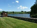
Freiberg mine ponds
|
Freiberg mine ponds
|
|
|
Middle pond in the city forest near Freiberg |
|
| location | Saxony , Germany |
| Identifier | 003E |
| WDPA ID | 555520420 |
| Natura 2000 ID | 5045-301 |
| FFH area | 3.05 km² |
| Sea level | from 440 m to 590 m ( ø 490 m) |
| Setup date | 2002 |
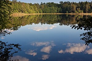
The Freiberg mine ponds are a fauna and flora habitat (FFH) in Saxony . The area comprises ten scattered areas with a total of 305 hectares in the south of Freiberg . Flora and fauna are protected in the artificial ponds , ironworks and stamping ponds created by mining , as well as adjacent meadows and forests .
location
The ten sub-areas extend approximately in a north-south direction from Freiberg via Brand-Erbisdorf , Weißenborn / Erzgeb. , Großhartmannsdorf , Mulda / Sa. to Pfaffroda and Sayda about 23 km. Seven ponds are connected to each other via the artificial ditches and roses of the Freiberg Revierwasserlaufanstalt (RWA).
Partial areas
BWV = industrial water supply , F = fishing , HWS = flood protection , K = hydropower , NEG = recreation area , NSG = Nature Reserve , TWV = drinking water supply
purpose
Four conservation objectives have been defined for this FFH area:
- Preservation of a pond area system, consisting mainly of mesotrophic waters with vegetation on temporarily dry sand and mud soils, which are connected by ditches, as well as the adjacent mountain meadows and near-natural forest areas. The ponds represent important cultural monuments of the medieval mining industry in the region.
- Preservation or restoration of "natural habitats of community interest" (especially the oligo- to mesotrophic standing waters with species-rich and extensive pond floor vegetation)
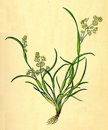
- Preservation or restoration of “animal and plant species of Community interest” (in particular otters , great mouse-eared mouse , crested newt and vaginal bloom ).
- Particular importance is attached to maintaining or promoting the lack of fragmentation and functional cohesion of the habitat type and habitat areas of the area, avoiding internal and external disruptive influences on the area and ensuring functional coherence within the NATURA 2000 regional system, which are decisive aspects of the consistency requirement of the FFH -RL is met.
literature
- Bergmännischer Verein zu Freiberg (Ed.): Freibergs Berg- und Hüttenwesen . A brief description of the orographic, geological, historical, technical and administrative conditions. Craz & Gerlach, Freiberg 1883, p. 97-102 ( Text Archive - Internet Archive [accessed February 11, 2012]).
- Otfried Wagenbreth : The Freiberg mining . Technical monuments and history. Ed .: Eberhard Wächtler . 2nd Edition. German publishing house for basic industry, Leipzig 1988, ISBN 3-342-00117-8 , p. 62-72 .
Individual evidence
- ↑ Nature and the environment in the council and hospital forest
- ^ Illustration from Otto Wilhelm Thomé: Flora of Germany, Austria and Switzerland. Gera-Untermhaus, 1885.
