
Little Bockau
| Little Bockau | ||
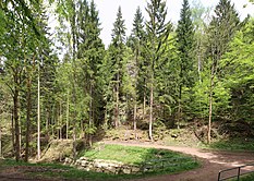
.jpg) Kleine Bockau in Höllengrund |
||
| Data | ||
| location | Saxony , Germany | |
| River system | Elbe | |
| Drain over | Große Bockau → Zwickauer Mulde → Mulde → Elbe → North Sea | |
| source | at Auersberg 50 ° 27 ′ 28 ″ N , 12 ° 39 ′ 46 ″ E |
|
| Source height | approx. 845 m | |
| muzzle | near Sosa in the Große Bockau coordinates: 50 ° 29 '59 " N , 12 ° 37' 35" E 50 ° 29 '59 " N , 12 ° 37' 35" E |
|
| Mouth height | approx. 514 m | |
| Height difference | approx. 331 m
|
|
| Reservoirs flowed through | Sosa dam | |
The Kleine Bockau is a right tributary of the Große Bockau in the Western Ore Mountains in the Free State of Saxony . According to the natural map of Saxony, the “Valley of the Little Bockau” represents its own microgeochore and is part of the “Eibenstocker Bergrücken” mesogeochore.
Surname
The name is derived from the Old Sorbian Bukova for beech water . In the Saxon miles sheets of 1791 the river is still called "Kleine Buckau". Neither the small nor the large Bockau flow through the municipality of Bockau ; this village is in a different valley further northeast.
course
The Kleine Bockau rises in the depression formerly called Auersberger Grund between Auersberg and Riesenberg at an altitude of about 850 m above sea level. NN and flows in a deep valley in a northeastern direction. It flows through a pewter soap base with many Raithalden as relics of the pewter soap. The water is dammed up by the Sosa dam. The Kleine Bockau used to flow to the Neudecker Bach from the east, this now flows directly into the dam. South of the “Pension Zimmeracher” the Kleine Bockau flows into the Große Bockau , the water of which flows into the Zwickauer Mulde at a height of about 480 m at the former Blauenthal train station . Below the dam, the bottom of Hell is deeply cut. On both sides of the stream, rocks rise up to a height of up to 25 meters.
The Auersberg houses stood not far from the source of the stream .
On the Kleine Bockau - like on the Große Bockau - wood was rafted.
Mining
The “Six Brothers Unity” mine, mentioned in 1748 as a hybrid mine, was located near the Kleine Bockau, of which a tunnel still existed in the 1960s. The tributaries were used for pewter soaping .
additional
In the past, the name "Kleine Bockau" was also used for the stream near Pockau , which is now called "Rote Pockau" .
gallery
- The Kleine Bockau between the Sosa dam and its confluence with the Große Bockau
Rocks below the barrier wall

Stony stream
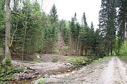
Landslide and ford for wood removal

Old dams

Forest conversion not completed

Confluence of the small ones in the Große Bockau (front)
.jpg)
.jpg)
.jpg)
.jpg)
.jpg)
.jpg)
Web links
- "Die kleine Buckau" on sheet 221 of the Meilen Blätter von Sachsen - Berlin copy from 1791 ( link to the digitized version in the Dresden State and University Library )
- Upper course of the Kleine Bockau in the equidistant rate 145 - Section Eibenstock - from 1875
- Upper course of the Kleine Bockau in the equidistant map 145 - Section Eibenstock - from 1897
- The Kleine Bockau in the upper course in the topographic map 145 - Eibenstock - from 1904
Individual evidence
- ↑ Research map of the Landscape Research Center Dresden (LfZ) Link to the research map
- ↑ a b The mining landscape of Schneeberg and Eibenstock (= values of the German homeland . Volume 11). 1st edition. Akademie Verlag, Berlin 1967, p. 143.
- ↑ Sheet 221 of the Sächsische Meilenblätter (Berlin copy) from 1791 Link to the map in the Saxon State and University Library in Dresden
- ^ The mining landscape of Schneeberg and Eibenstock (= values of the German homeland . Volume 11). 1st edition. Akademie Verlag, Berlin 1967, p. 145.
- ↑ a b Topographic map 1: 25,000, edition with hiking trails, sheet 15 Westerzgebirge Eibenstock, Johanngeorgenstadt, Sächsischer Staatsbetrieb Geobasisinformation und Vermessung, 2nd edition, Dresden 2010, ISBN 978-3-86170-717-2
- ↑ Communications from the Statistical Association for the Kingdom of Saxony, 3rd delivery, contributions to the topography and climatic conditions of the Kingdom of Saxony, from Christian Wilhelm Vogel, Leipzig 1833, p. 4 digitized version , accessed on April 29, 2015.
- ^ The mining landscape of Schneeberg and Eibenstock (= values of the German homeland . Volume 11). 1st edition. Akademie Verlag, Berlin 1967, p. 151.
- ↑ Karl von Weber (Ed.): Archive for the Saxon History , Volume 5, Bernhard Tauchnitz Verlag, Leipzig 1867, p. 250 digitized